





Balboa Island asks 45% more than Newport Beach as a whole.
Newport Beach, California · Neighborhood guide
Balboa Island
A dredged-up island in Newport Harbor, with cottages on 30-foot lots and a car ferry that's run since 1919
Median askingBalboa Island$6.1M12 for sale
See homesBalboa Island, in short.
Balboa Island is a man-made island in Newport Harbor, built from dredged sand starting around 1906 and part of the City of Newport Beach since 1916. Most lots are 30 by 85 feet. The 2020 census counted 2,490 residents and 2,035 homes in its ZIP code, 92662, and 460 of those homes were held for seasonal or occasional use. The only ways on are the Marine Avenue bridge at the end of Jamboree Road and the Balboa Island Ferry, which has run to the Peninsula since 1919. As of September 2026, homes for sale asked about $3.2 million to $14 million. Buyers should check the seawall plans, the parcel's flood zone, and the city's short-term rental cap.
Balboa Island by the numbers.
- 2,285Population
- 51%Homeowner-occupiedoccupied homes
- 68%Bachelor's degree or higherage 25+
- $11,000/moMedian asking rentCurrent MLS listings
- $162,045Median household income
- 61.2Median age
Sources: U.S. Census Bureau, ACS 5-year 2019–2023; neighborhood facts compiled by The Slava House.
An island village in the middle of Newport Harbor
Dredged out of the bay more than a century ago, with about 2,000 homes on 0.2 square miles.
Balboa Island is a man-made island in the middle of Newport Harbor. A short two-lane bridge from Jamboree Road reaches it, and so does the car ferry from the Balboa Peninsula. It covers about 0.2 square miles, and most of its lots measure 30 by 85 feet. A paved concrete boardwalk runs the whole way around the seawall. Marine Avenue, the main commercial street, cuts across the middle.
The island is really three. Balboa Island proper is the big one. Little Balboa Island sits across the Grand Canal to the east, joined by a two-lane bridge. Collins Island, the smallest, sits off the northwest corner behind a one-lane bridge. Together they form one neighborhood with one ZIP code, 92662.
The census shows how the island gets used. In 2020, ZIP 92662 had 2,490 residents and 2,035 homes, and 460 of those homes were held for seasonal or occasional use. Winter weekdays are quiet. Summer means renters and a line for the ferry. There are almost no yards and not much parking, the seawalls are old and low, and the city watches short-term rentals and coastal construction closely.
Live from the MLS
Balboa Island compared with all of Newport Beach.
A square foot in Balboa Island costs 63% more than across Newport Beach.
Balboa Island$2,442
All of Newport Beach$1,500
Listings in Balboa Island have been on the market 20 fewer days than across Newport Beach.
What’s for sale
50% of the homes for sale in Balboa Island are single-family houses.
- Single-family50%6 homes
- Multi-unit33%4 homes
- Other17%2 homes
Homes for sale in Balboa Island are 6% smaller than across Newport Beach.
Balboa Island2,372 sq ft
All of Newport Beach2,511 sq ft
Each card sets the median in Balboa Island against all of Newport Beach. The arrow on a card lists every Newport Beach neighborhood we cover. Asking prices for homes on the market right now inside each mapped area, not sale prices. Updated October 3, 2026, 5:00 PM PT
Homes for sale in Balboa Island
12 active listings in the mapped area
$5,799,000
Single-Family3 bd3 ba2,354 sqft
119 Opal
$7,495,000
Duplex4 bd5 ba3,479 sqft
327 Amethyst
$3,490,000
Duplex
121 Marine Avenue
$3,490,000
Duplex3 bd3 ba1,633 sqft
121 Marine Avenue
$6,395,000
Single-Family3 bd4 ba2,321 sqft
118 Sapphire
$13,995,000
Single-Family3 bd5 ba2,389 sqft
1105 N Bay Front
$10,995,000
Single-Family4 bd6 ba2,501 sqft
113 Grand Canal
$3,195,000
Mixed Use3 bd4 ba3,026 sqft
122 Agate
$3,195,000
Mixed Use
122 Agate
$925,000
Residential4 bd3 ba2,157 sqft
305 Grand Canal 8
$7,990,000
Single-Family4 bd6 ba3,300 sqft
330 Onyx Avenue
$9,495,000
Duplex4 bd4 ba2,003 sqft
1407 N Bay Front

Still deciding? Ask me.
I’m a Realtor based in Long Beach, and Newport Beach is one of the cities I work most. Tell me what you’re after in Balboa Island and I’ll help you get there.
Slava Ploshkin · DRE #02323623English and Russian · How I work in Newport Beach
Where to eat, shop, and explore in Balboa Island
The restaurants, cafes, shops, parks, and landmarks that give Balboa Island its everyday character, most within a short walk.
10 places
Pick one and I’ll show you where it is.
Shopping10 min walk
The island's main commercial street: a few short blocks of restaurants, bakeries, tackle and craft shops between the bridge and the south bayfront.
Curb parking on Marine Avenue is limited to two hours; islanders walk or bike over from the side streets.
Landmark5 min walk
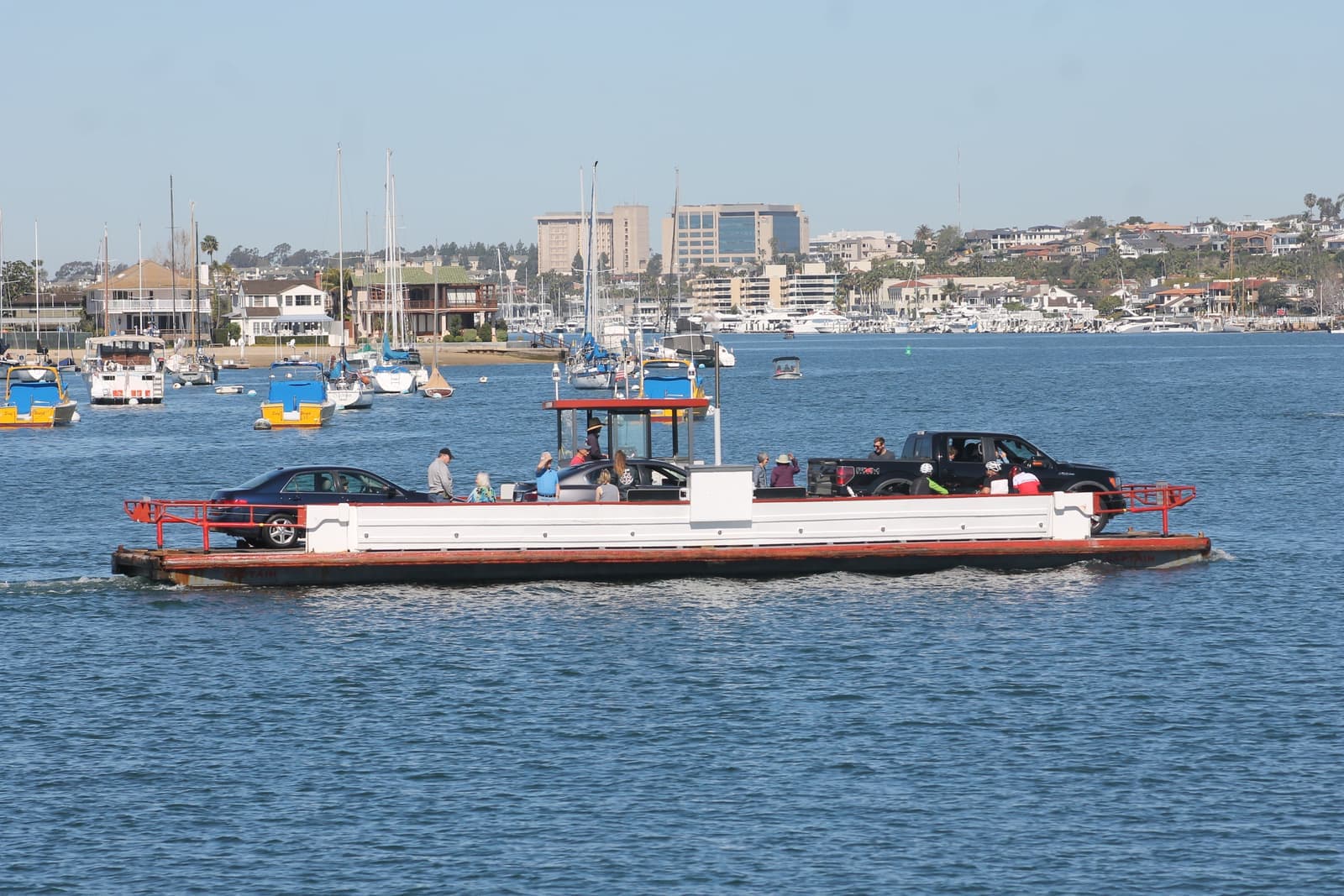
Running since 1919, the Beek family's three wooden ferries each carry three cars and 75 passengers across roughly 800 feet of harbor to the Fun Zone.
Boats run 6:30 a.m. to midnight every day of the year, docking about every five minutes.
Landmark10 min walk
The local history museum at 210 Marine Avenue, free and open daily 10 to 5, in a 1927 building that doubled as the island's fire station until 1931.
Restaurant10 min walk
Hand-dipping frozen bananas and Balboa Bars at 310 Marine Avenue since 1945, and one side of the island's old argument over who made the first Balboa Bar.
Coffee10 min walk
The island's morning donut counter a few doors up Marine Avenue, and the other claimant to the first Balboa Bar.
Restaurant10 min walk
A family-style restaurant at 203 Marine Avenue, a longtime island standby for breakfast and casual dinners.
Nightlife10 min walk
The island's longtime bar near the south end of Marine Avenue, known to locals as the VI.
Beach10 min walk
The narrow canal between Balboa Island and Little Balboa Island, with docks along it. The Park Avenue bridge across it was rebuilt and reopened in July 2017.
The canal's wooden bulkhead and walk were rebuilt in concrete in 1929.
Landmark · Nearby10 min walk
The 1906 pavilion at the ferry's Peninsula landing, a California Historical Landmark and National Register site, with the 1936 Fun Zone and its Ferris wheel next door.
Beach · Nearby15 min walk
The Peninsula's ocean pier and beach, a ferry ride plus a short walk from the island, with the open Pacific that the harbor side lacks.
What it's like to live near Marine Avenue
A few blocks of small businesses that serve the whole island on foot.
Marine Avenue is the island's main commercial street, running from the bridge down to the south bayfront, with a few more shops on Agate Avenue by the ferry. You'll find restaurants, bakeries, a fishing and tackle shop, and craft stores. Sugar 'n Spice has sold hand-dipped frozen bananas and Balboa Bars at 310 Marine Avenue since 1945. It and Dad's Donut & Bakery, a few doors up, have argued since the 1960s over who made the first Balboa Bar. The Village Inn, the island's longtime bar, sits near the south end of the street.
Marine Avenue also has the island's history museum. The Newport Beach Museum began as the Balboa Island Museum and opened its current space at 210 Marine Avenue in December 2018. The building went up in 1927 as a yacht brokerage and marine-supply store and doubled as the island's fire station until 1931. Admission is free, it's open daily 10 to 5, and the exhibits cover the ferry, Collins Island, the Fun Zone, and the island's early families.
The street changes with the calendar. In summer it fills with people off the ferry and renters from the cottages, and in December the Christmas Boat Parade crowds pack the bayfront. The rest of the year, weekday mornings are quiet. A house a block or two off Marine Avenue gets the convenience without the foot traffic, and I always check which side of that line a listing sits on.
- Restaurants, bakeries, tackle, and crafts, all reachable on foot
- Sugar 'n Spice and Dad's both claim the first Balboa Bar
- Free local history museum at 210 Marine Avenue, open daily
How Balboa Island was built from dredged sand
A mudflat turned island that nearly failed before the city took it in.
In 1902 William Stepp Collins and a partner bought land around Newport Bay. By 1906 Collins had a dredge cutting a channel on the north side of the bay. The sand and silt went onto the tidal flats, and the flats became Balboa Island. Progress was uneven: a 1909 newspaper report noted the collapse of one hundred feet of seawall. By 1910 the island was open to the public with about twenty houses built.
Waterfront lots first sold for around $650 and inland lots for $350. Flooding, snagged utility lines, and sewers that emptied onto the beaches drove owners away, and lot prices later fell as low as $25. Collins sold his island holdings in 1915, and in 1916 the residents agreed to join the City of Newport Beach to save the place. Newport Beach itself had incorporated only in 1906, with 206 residents. In 1919 Joseph Allan Beek won the contract for a ferry to the Peninsula, and in 1920 the Fat Fairy went into service, carrying up to 20 passengers for a nickel each.
The 1920s built the island people recognize today. The Beek family founded the Balboa Island Yacht Club in 1922 as a club run by kids, with a child serving as commodore. The Grand Canal's wooden bulkhead and walk were rebuilt in concrete in 1929, and island residents paid for the first Park Avenue bridge to Little Balboa Island around the same time. By 1929 about 100 people lived on the island year-round. Jamboree Road, the mainland approach, takes its name from the 1953 Boy Scout Jamboree held nearby. The island marked its centennial in 2016 with a parade.

- Dredging began in 1906; the island opened to the public in 1910
- Annexed by Newport Beach in 1916 after the original developer failed
- Ferry from 1919, a kids' yacht club from 1922, concrete canal walls from 1929
Living on the harbor
On the island, the harbor is your commute and your evening walk.
The Balboa Island Ferry has run since 1919 and is still in the Beek family, with Seymour Beek as president. Its three double-ended wooden boats, the Admiral, the Commodore, and the Captain, were built in the 1950s, and each carries three cars and 75 people. The crossing is about 800 feet, at a top speed of four miles per hour, with a boat docking about every five minutes from 6:30 a.m. to midnight, 365 days a year. Those boats are due to be replaced: in February 2026 the ferry signed grant contracts with the South Coast Air Quality Management District and the California Air Resources Board, backed by $7.9 million, to swap all three diesel boats for battery-electric ferries.
The boardwalk is the other daily ritual. A paved concrete walk circles the community on top of the seawall, open to pedestrians. The harbor is on one side, and the bay-front houses with their docks are on the other. Newport Harbor holds roughly 9,000 boats and is one of the largest recreational harbors on the West Coast, so there's always something moving past.
The Christmas Boat Parade began as a lighted boat parade on July 4, 1908, with nine vessels led by a lantern-decorated gondola. Joseph Beek revived it in 1919 as a summer Tournament of Lights, which ran most years until 1949. The December version grew out of a barge that city employees decorated with a lighted Christmas tree in 1946. The 118th parade runs December 16 to 20, 2026, and bay-front homes on the island are some of the best seats.

- Ferry since 1919: three cars and 75 people per boat, every five minutes
- All three boats are slated for battery-electric replacements
- The 1908 lighted boat parade became today's December Christmas Boat Parade
Homes on the island's 30-foot lots
The lot is the product; what stands on it runs from 1920s cottage to new build.
Most of the island was platted on 30-by-85-foot lots, 2,550 square feet, and the island has its own zoning district, R-BI, which allows up to two units on a lot. The original houses were small beach cottages, and many survive with front patios facing the street or the boardwalk. Over the decades a large share have been replaced by two-story homes that use the whole lot. Active listings in September 2026 ran from a 1932 duplex to houses finished in 2026.
Location sets the tiers. Bay-front houses on North Bay Front and South Bay Front sit on the boardwalk with the harbor and docks in front of them. Homes along the Grand Canal and on Little Balboa Island face narrower water and quieter foot traffic. Interior lots on the cross streets named for precious stones, Sapphire, Emerald, Onyx and the rest, are the most common product and the entry point.
If you're coming from a bigger lot, reset your expectations. Outdoor space means a patio, a roof deck, or the boardwalk itself. Garages are small and parking is scarce, so an off-street space is a real asset. By 2008 original cottages on interior lots were already selling as teardowns for the land alone, and I still price island homes that way: the lot and its position first, the house second.
- Most lots are 30 by 85 feet; product runs from original cottage to new build
- Bay front, Grand Canal, Little Balboa, and interior lots form the tiers
- R-BI zoning allows up to two units per lot
Why Balboa Island costs what it does
Nobody can make more island, and three kinds of buyers want what's there.
There's a fixed number of lots on the island and no way to add more. As of September 2026, about ten homes and small income properties were for sale, asking roughly $3.2 million to $14 million: duplexes from about $3.5 million, single-family houses from about $4.9 million, and new bay-front houses at the top. Two homes with the same floor plan can trade very differently depending on whether they face the harbor, the canal, or an interior street.
Demand comes from more than one direction. Year-round residents want the walkable village, and second-home owners want a harbor house they can reach in an hour. Investors have historically counted on summer renters, since local estimates put the summer population at roughly double the winter one. The city's cap on short-term-lodging permits and its wait list have changed that last calculation, so I underwrite any rental plan against the current rules, not an old listing's income claims.
I price a specific street off a recent comparable-sales report, then add the island's carrying costs. Flood insurance is required in a special flood hazard area with a federally backed loan, and since October 2024 the city's Community Rating System class has cut those premiums by 20 percent. Central Balboa Island's power lines went underground in 2024 and 2025 through Underground Utility Assessment District No. 124, which property owners fund, so check the tax bill for that assessment. Bay-front lots add dock upkeep and the city pier permit; the seawall itself belongs to the city.

- About $3.2 million to $14 million asking as of September 2026
- Residents, second-home buyers, and summer-rental investors all compete
- Check flood insurance, undergrounding assessments, and rental permit status
What to check before you buy on Balboa Island
The seawalls come first, then flood maps, rental rules and coastal permits.
The seawalls come first. In August 2017 the City Council voted 6-0 to add a 9-inch concrete cap to walls the city described as 80 to 90 years old, at a cost of $1.5 to $2 million. The cap raised them to 8.5 feet on the north side and 9 feet on the south side, and the city engineer called it a fix for the next 10 to 20 years. Full replacement, estimated at $68 million in 2017, is now priced at about $136.6 million in the city's 2024 Harbor and Beaches Master Plan. The 2025-26 capital budget funds design and permitting, with a first construction phase tentatively set for the 2027-28 fiscal year. Until then, crews install removable boards in gaps along the bay-front walls before king tides, as they did in December 2025 and again in June and July 2026.
The city's 2014 hazard plan explains how the streets stay dry. The city runs 86 tide valves that keep high tides off the streets of Balboa Island and the Peninsula, and pumps clear the runoff that ponds behind them. The plan also warns that a 100-year flood could overwhelm the pumps and leave the island under water until the storm abates. FEMA's preliminary 2016 maps would have put more of Newport Beach in flood zones; after two years of work with the city, the revised maps greatly reduced the number of properties that must carry flood insurance, though some on Balboa Island stayed in or were added. Those maps took effect March 21, 2019, so check the exact parcel on the city's viewer and FEMA's Map Service Center.
Then the rules. Short-term lodging is any rental of 30 days or less. It needs a city permit and business license, carries a 10 percent transient occupancy tax, requires stays of at least two nights and renters 25 or older, and has been banned in single-family (R-1) districts since 1992. Permits are capped at 1,550 citywide; since a Coastal Commission approval in May 2025, 1,475 of them are for residential districts and 75 for two mixed-use zones. The city isn't issuing new permits while it's at the cap, so newcomers join a wait list, and an existing permit can be transferred only under the city's rules. The city's island-specific rental limits apply to Newport Island, not Balboa Island. Finally, the whole island lies in the coastal zone. The city has issued most coastal development permits since its Local Coastal Program took effect January 30, 2017. House and duplex projects on lots that don't abut the harbor are generally excluded from those permits, but bay-front lots need one and stay in the Coastal Commission's appeal area.
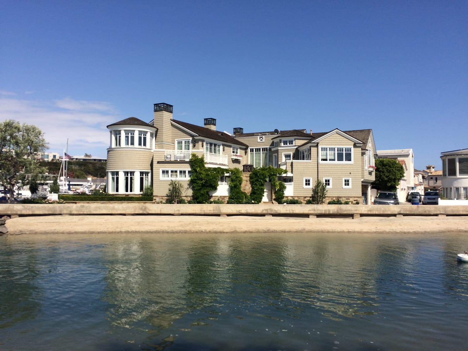
- Seawalls capped in 2017; replacement priced at about $136.6 million, in design
- Verify the flood zone per parcel; maps effective March 21, 2019
- Short-term rentals: permit, two-night minimum, 1,550 cap, wait list, none in R-1
- Bay-front lots need coastal permits and remain appealable
Getting on and off the island
On the island you walk. Everything else starts at the bridge.
Every car trip starts at the Marine Avenue bridge, which lands on Bayside Drive at the foot of Jamboree Road. Jamboree runs north past Fashion Island toward John Wayne Airport and the freeways. Bayside Drive connects to Coast Highway for Corona del Mar and the Peninsula. The state's May 2013 bridge list called the Marine Avenue bridge functionally obsolete, a design-standard label rather than a structural rating. The Park Avenue bridge to Little Balboa Island was replaced with a wider one that reopened in July 2017, and the city is designing a replacement for the one-lane Collins Island bridge.
The ferry is the shortcut. It carries cars and pedestrians to the Balboa Peninsula in a few minutes, which puts the Fun Zone, the Pavilion, Balboa Pier, and the ocean beach within a short trip without driving around the harbor. The city also plans to run its summer trolley to Balboa Island starting in 2027. Inside the island, the streets are flat and short, so most errands happen on foot or by bike. Street parking is scarce, and summer weekend visitors back up Marine Avenue, so a garage or dedicated space matters more here than almost anywhere in the city.

- Marine Avenue bridge to Bayside Drive and Jamboree Road for the mainland
- The car ferry reaches the Peninsula, the Pavilion, and the ocean beach
- Flat, short streets you can walk; parking is scarce
More Balboa Island facts
- 1906DredgedW.S. Collins's dredge began building the island
- 1916Joined the cityAnnexed by Newport Beach
- 1919Ferry sinceThree cars and 75 people per boat
- 30 × 85 ftStandard lotThe original subdivision
- 2,035Homes (2020)ZIP 92662; 460 held for seasonal use





Rentals in Balboa Island
23 active rentals in the mapped area
$3,750/mo
Apartment1 bd1 ba490 sqft
117 1/2 Amethyst Ave
$3,900/mo
Duplex1 bd1 ba924 sqft
1007 Balboa Ave. Avenue
$4,750/mo
Duplex2 bd2 ba800 sqft
315 1/2 Diamond Avenue
$13,000/mo
Duplex3 bd3 ba1,800 sqft
110 Pearl Avenue
$4,300/mo
Duplex2 bd1 ba816 sqft
130 Topaz 1/2
$11,000/mo
Single-Family3 bd3 ba2,000 sqft
219 Diamond Avenue
$18,500/mo
Single-Family3 bd4 ba2,485 sqft
115 Topaz
$2,750/mo
Duplex1 bd1 ba500 sqft
112 1/2 Pearl
$10,000/mo
Single-Family4 bd4 ba2,183 sqft
498 Park Ave
$21,995/mo
Single-Family3 bd4 ba2,312 sqft
201 Opal Avenue
$28,500/mo
Single-Family3 bd4 ba2,347 sqft
203 Sapphire
$65,000/mo
Single-Family4 bd6 ba4,482 sqft
130 S Bay Front
$5,900/mo
Duplex2 bd2 ba791 sqft
212 1/2 Garnet
$7,000/mo
Condo3 bd2 ba1,050 sqft
114 1/2 Onyx
$8,000/mo
Duplex3 bd2 ba1,200 sqft
216 Collins
$12,000/mo
Duplex3 bd2 ba1,200 sqft
1009 N Bay Front


Questions & answers
Yes, if you want a walkable harbor village and can live with small lots, tight parking, and flood-risk homework. The whole island is a few minutes on foot from end to end. Marine Avenue covers daily needs, a concrete boardwalk circles the seawall, and the ferry reaches the Peninsula and the ocean beach. What you put up with: 30-by-85-foot lots with almost no yard, summer crowds, and seawalls the city plans to replace. The city also enforces strict rules on short-term rentals and coastal construction.
Explore near Balboa Island
0.8 mi awayBalboa PeninsulaBeach cottages and bay-front houses on a sandspit between the Pacific and Newport Harbor, from Cannery Village to the WedgeRead the guide ›1.5 mi awayCorona del MarThe bluff-top village at the harbor mouth, where the Flower Streets run down to two beachesRead the guide ›3.7 mi awayNewport CoastThe Irvine Company's gated hillside villages, built in the 1990s and 2000s above Crystal Cove State ParkRead the guide ›5.5 mi away · IrvineTurtle RockIrvine's first hillside village, started in 1967, with two elementary schools inside and Bommer Canyon out the backRead the guide ›6.2 mi away · IrvineUniversity ParkIrvine's first village, from the mid-1960s, where the houses face shared parks instead of the streetRead the guide ›7.2 mi away · IrvineWoodbridgeThe Irvine village built around two lakes, where the first homes went by lottery in 1976Read the guide ›
Where we check the facts
The facts in this guide (districts, zones, rules) come from the official records below. We re-check them before property tours.
- City of Newport Beachnewportbeachca.govtide valves, flood maps, parking, capital projects
- Newport Beach Local Coastal Program FAQnewportbeachca.govcoastal development permits, exclusions and appeal areas
- Newport Beach Short Term Lodging FAQnewportbeachca.gov30-day definition, eligible zones, 1,550 cap, TOT
- California Coastal Commission: Newport Beach STR amendment (May 2025)documents.coastal.ca.gov1,475 residential and 75 mixed-use permits, two-night minimum
- Newport-Mesa Unified School District: school locatorweb.nmusd.usassigned schools by address
- U.S. Census Bureau, 2020 Census (ZCTA 92662)data.census.govresidents, housing units, seasonal homes
Show all 16 sourcesShow fewer
- Balboa Island Ferrybalboaislandferry.comferry hours and crossing
- Newport Beach Museumnbmuseum.orgisland history and 210 Marine Avenue
- Stu News Newport: Council planning session (Feb 2024)stunewsnewport.comBalboa Island seawall replacement estimate and schedule
- FEMA Flood Map Service Centermsc.fema.govflood zones by address
- CRMLSgo.crmls.orglisting and market data
- Harbor Tideland Charges (City of Newport Beach)newportbeachca.govstate-owned tidelands assigned to the city in 1978
- Navigating Newport Harbor's Future (City of Newport Beach)newportbeachca.govState Lands Commission finding on residential pier rent, 850-plus piers, 2026-27 timeline
- Harbor Dock & Pier Permits (City of Newport Beach)newportbeachca.govpier permit transfers at sale, inspection, Municipal Code 17.35 and the pier and float map
- The Log: A higher seawall coming to Balboa Island (August 2017)thelog.comthe island's city-owned seawall
- Christmas Boat Paradechristmasboatparade.comparade history and 2026 dates
Photo credits (9)
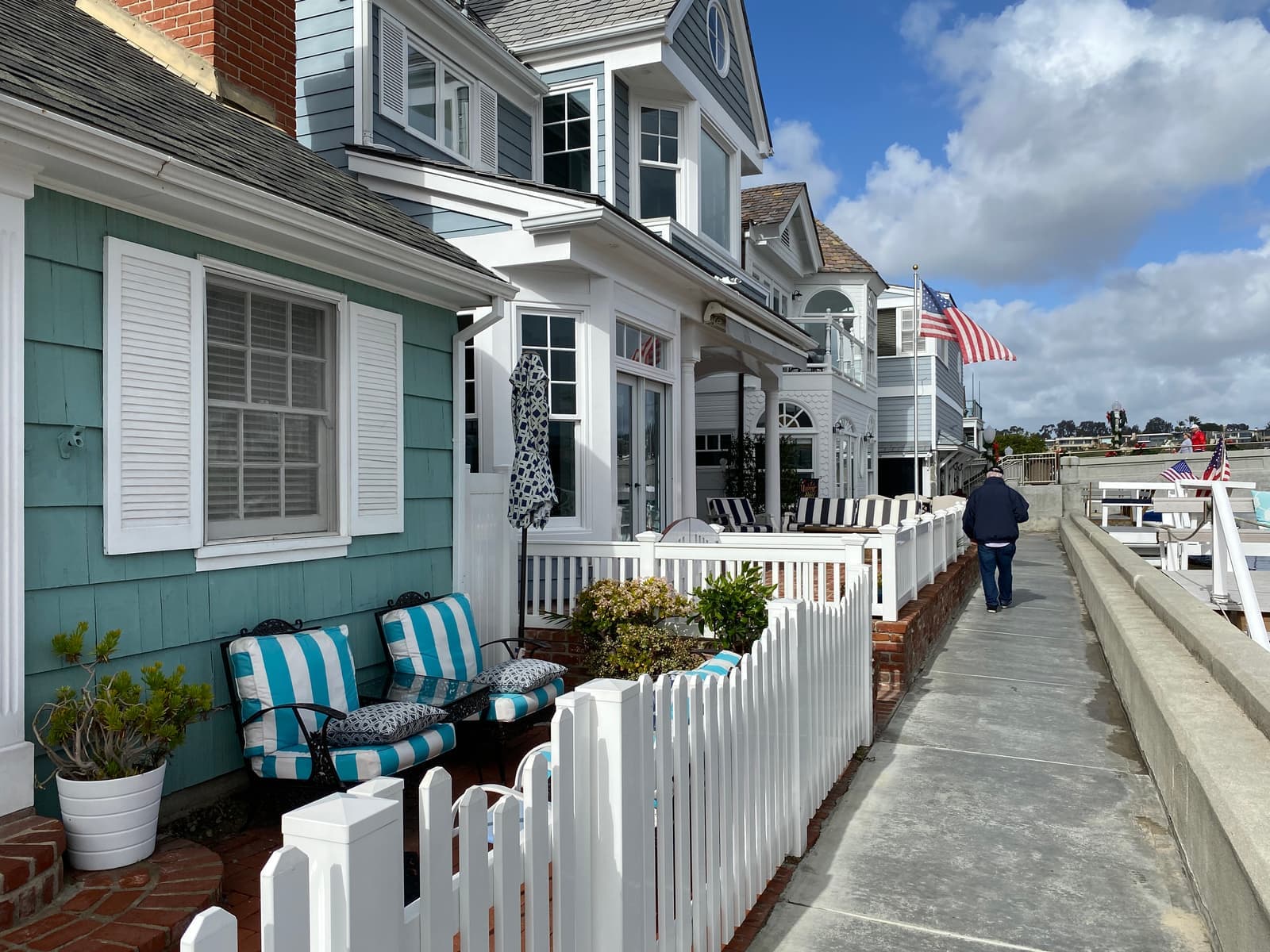
- Cottages and picket fences along the Grand Canal walk on Balboa IslandTracie Hall, CC BY-SA 2.0
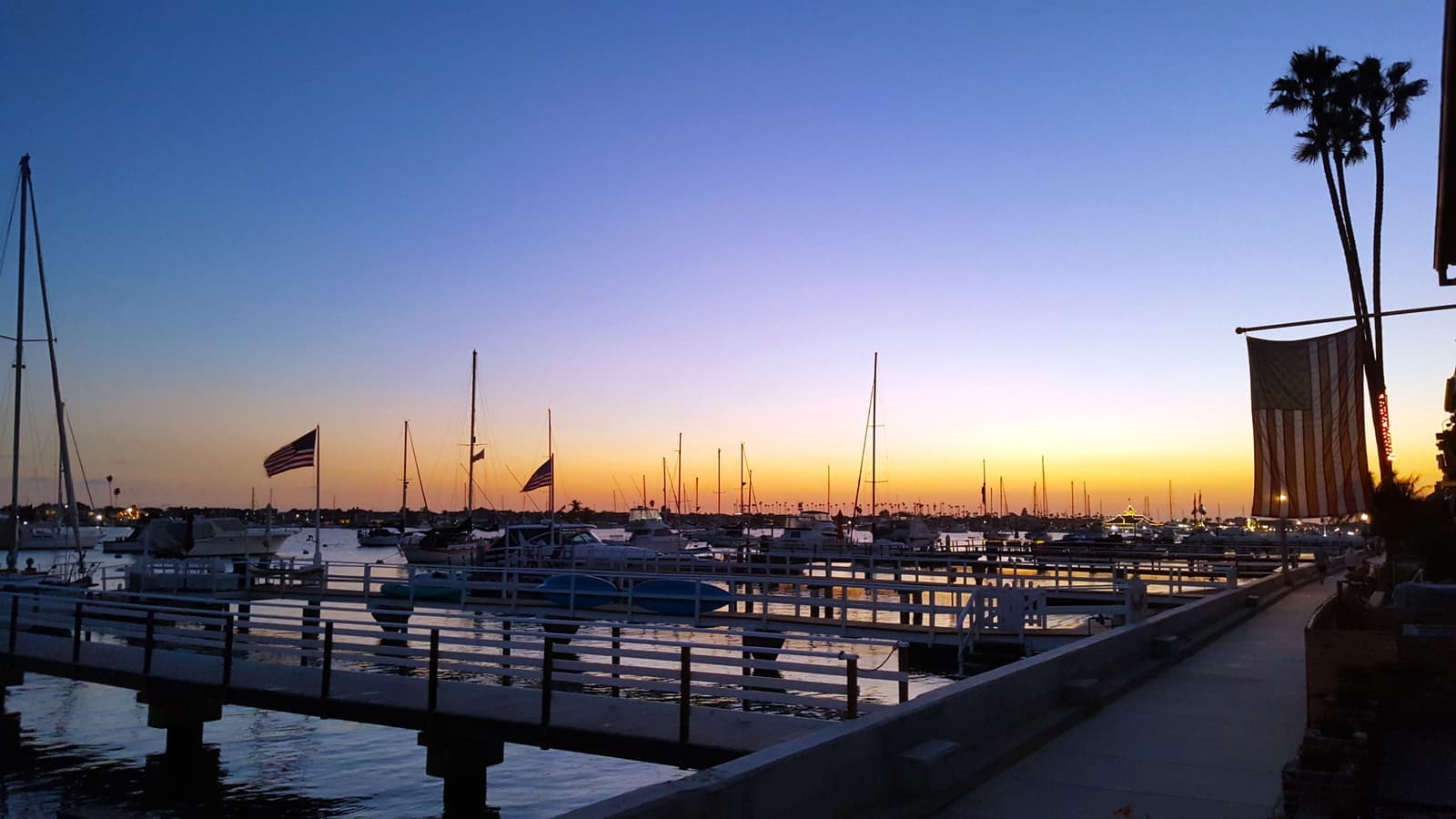
- Sunset over the docks from the bayfront walk on Balboa IslandDon Ramey Logan, CC BY 4.0
- The Balboa Island Ferry crossing the harbor with cars and riders on deckNoah Wulf, CC BY-SA 4.0
- Roses in bloom at a yellow cottage on the bayside walk of Balboa IslandTracie Hall, CC BY-SA 2.0
- A small bay beach and private docks below the homes of Balboa IslandForsaken Fotos, CC BY 2.0
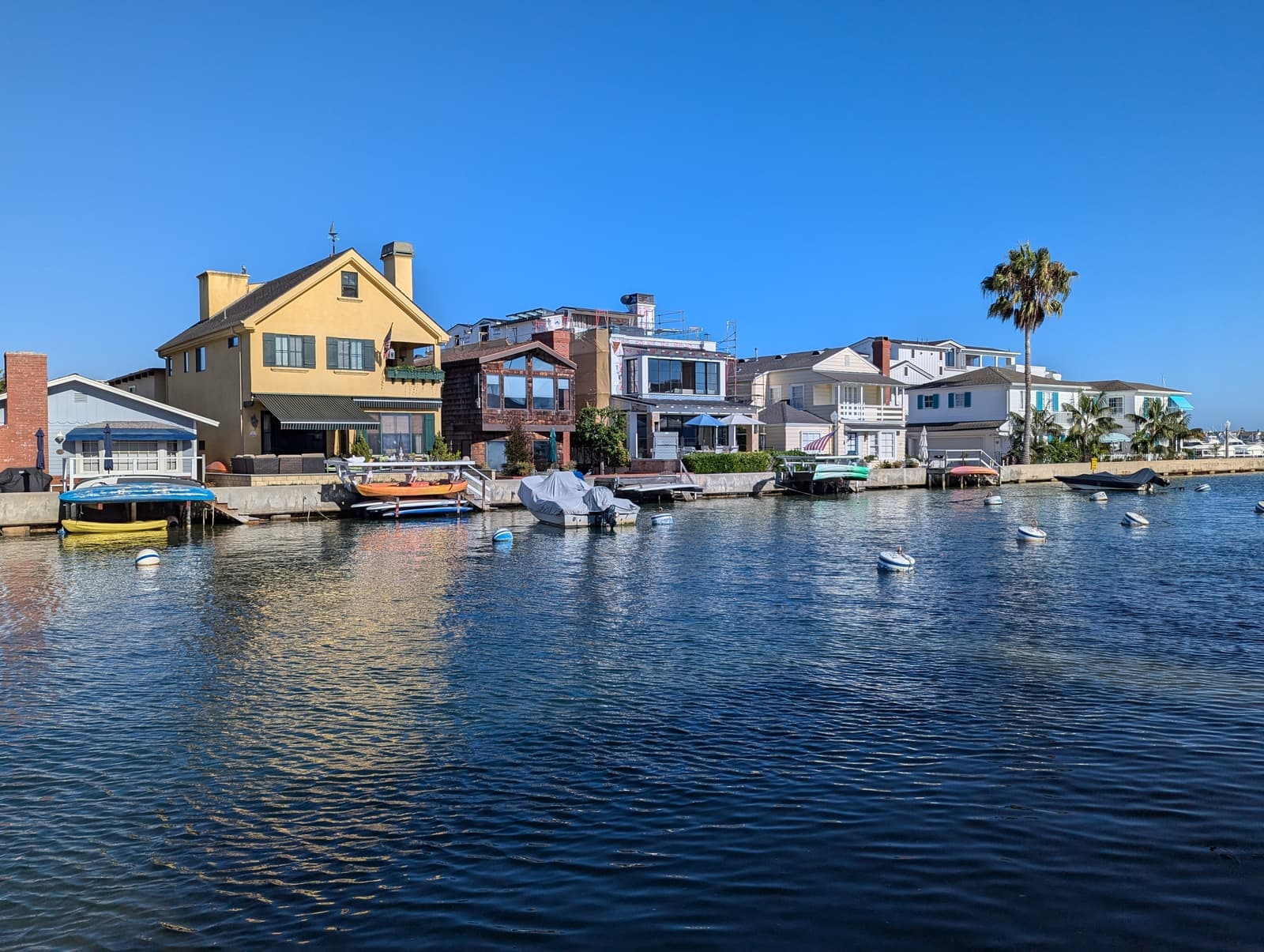
- Homes and moored boats along the Grand Canal on Balboa Island in late afternoon lightJeremy Thompson (Roller Coaster Philosophy), CC BY 2.0
- Rocking chairs and potted geraniums on a brick front patio on Balboa IslandTracie Hall, CC BY-SA 2.0
- A shingled house behind the seawall on the Grand Canal, with sand showing at low tideSergei Gussev, CC BY 2.0
- The Marine Avenue bridge, Balboa Island's only road link to the mainland, late in the dayDon Ramey Logan, CC BY-SA 4.0