





Balboa Peninsula asks 36% more than Newport Beach as a whole.
Newport Beach, California · Neighborhood guide
Balboa Peninsula
Beach cottages and bay-front houses on a sandspit between the Pacific and Newport Harbor, from Cannery Village to the Wedge
Median askingBalboa Peninsula$5.7M51 for sale
See homesBalboa Peninsula, in short.
The Balboa Peninsula is the sandspit in Newport Beach that separates Newport Harbor from the Pacific, running a little over three miles from Cannery Village and the Newport Pier east to the Wedge at the harbor entrance. It grew around the Balboa Pavilion and Balboa Pier, both built in 1906 when the Pacific Electric line reached Balboa. Homes are mostly cottages, duplexes, and rebuilt houses on lots of roughly 2,200 to 3,000 square feet, with bay-front houses and docks on the harbor side. In late September 2026, single-family houses were asking about $2.7 million to more than $50 million, most between $4 million and $11 million.
Balboa Peninsula by the numbers.
- 3,406Population
- 41%Homeowner-occupiedoccupied homes
- 60%Bachelor's degree or higherage 25+
- $13,500/moMedian asking rentCurrent MLS listings
- $207,554Median household income
- 46.8Median age
Sources: U.S. Census Bureau, ACS 5-year 2019–2023; neighborhood facts compiled by The Slava House.
A sandspit between the harbor and the ocean
Where the Peninsula starts and ends, for this guide.
The Balboa Peninsula is a sandspit a little over three miles long that closes Newport Harbor off from the Pacific. Balboa Boulevard runs down the middle. On one side is the ocean beach with a boardwalk; on the other is the harbor, with bay-front houses, docks, and boats. At the east tip is the Wedge, next to the jetty at the harbor entrance.
For this guide I map it from 32nd Street, where Cannery Village meets Lido Village, east to the harbor entrance. That takes in McFadden Square and the Newport Pier, the long middle stretch of numbered streets, Balboa Village around the Pavilion and the Fun Zone, and Peninsula Point at the end, where the cross streets switch to letters. West Newport, Lido Isle, and the Lido Peninsula across the Rhine Channel are separate neighborhoods, and Balboa Island is a ferry ride away.
Addresses at the Newport Pier end use ZIP 92663, and most of the rest use 92661. The Balboa Pier and the Newport Pier are under two miles apart, and nearly every house is a short walk from both the sand and the bay.

Live from the MLS
Balboa Peninsula compared with all of Newport Beach.
A square foot in Balboa Peninsula costs 58% more than across Newport Beach.
Balboa Peninsula$2,375
All of Newport Beach$1,500
Listings in Balboa Peninsula have been on the market 50 days longer than across Newport Beach.
What’s for sale
49% of the homes for sale in Balboa Peninsula are single-family houses.
- Single-family49%25 homes
- Multi-unit35%18 homes
- Other12%6 homes
- Condo4%2 homes
Homes for sale in Balboa Peninsula are 9% bigger than across Newport Beach.
Balboa Peninsula2,732 sq ft
All of Newport Beach2,511 sq ft
Each card sets the median in Balboa Peninsula against all of Newport Beach. The arrow on a card lists every Newport Beach neighborhood we cover. Asking prices for homes on the market right now inside each mapped area, not sale prices. Updated October 3, 2026, 5:00 PM PT
Homes for sale in Balboa Peninsula
51 active listings in the mapped area
$3,395,000
Single-Family3 bd2 ba1,174 sqft
449 M Street
$6,250,000
Single-Family4 bd4 ba2,554 sqft
1517 Miramar Drive
$3,395,000
Multi-Family4 bd2 ba1,896 sqft
211 Cypress Street
$5,695,000
Quadruplex4 bd4 ba2,800 sqft
1609 E Balboa Boulevard
$5,695,000
Quadruplex
1609 E Balboa Boulevard
$4,195,000
Single-Family2 bd2 ba1,187 sqft
2004 E Ocean Boulevard
$8,980,000
Single-Family5 bd6 ba3,349 sqft
1416 E Balboa Boulevard
$4,599,000
Quadruplex
1733 W Balboa Boulevard
$4,150,000
Single-Family3 bd2 ba2,366 sqft
1706 E Ocean Boulevard
$2,400,000
Triplex
203 6th Street
$10,995,000
Single-Family5 bd4 ba3,742 sqft
1444 W Bay
$25,950,000
Single-Family5 bd6 ba3,821 sqft
1114 E Balboa Boulevard
$14,995,000
Single-Family4 bd6 ba3,341 sqft
928 E Balboa Boulevard
$7,495,000
Single-Family3 bd3 ba2,640 sqft
920 E Oceanfront
$4,500,000
Single-Family3 bd3 ba2,768 sqft
1913 Court Street
$8,495,000
Single-Family4 bd6 ba3,577 sqft
503 J

Still deciding? Ask me.
I’m a Realtor based in Long Beach, and Newport Beach is one of the cities I work most. Tell me what you’re after in Balboa Peninsula and I’ll help you get there.
Slava Ploshkin · DRE #02323623English and Russian · How I work in Newport Beach
Where to eat, shop, and explore in Balboa Peninsula
The restaurants, cafes, shops, parks, and landmarks that give Balboa Peninsula its everyday character, most within a short walk.
12 places
Pick one and I’ll show you where it is.
Recreation15 min walk
The pier built in 1906 with the Pavilion to sell lots in Balboa. Peninsula Park and the beach fire rings are at its foot.
The pier lot has 614 spaces and charges 24 hours a day, $4.50 an hour from May through September.
Beach45 min walk
The shore break beside the West Jetty at the tip of the Peninsula. South swells bounce off the rocks and stack into waves that can reach 30 feet.
Watch from the sand unless you're an experienced bodysurfer; lifeguards warn visitors before they go in.
Recreation25 min walk
The 1,032-foot pier rebuilt in 1940 on the site of the 1888 McFadden Wharf, California Historical Landmark No. 794. The lifeguard headquarters sits at its foot.
Shopping25 min walk
The beach fishing cooperative founded in 1891, working from the sand at the foot of the Newport Pier.
Recreation15 min walk
The harbor-side boardwalk of rides and arcades, opened in 1936, with its Ferris wheel.
Landmark15 min walk
The 1906 Victorian pavilion on the bay, a California Historical Landmark and the city's oldest standing building. The Catalina Flyer leaves from here.
Recreation15 min walk
The Peninsula landing of the car ferry that has crossed to Balboa Island since 1919, about 800 feet each way.
It's the fastest way to Marine Avenue without driving around the harbor.
Park15 min walk
The grass field and playground next to the Balboa Pier, in the middle of Balboa Village.
Park20 min walk
The city park and community center on the bay side at 1600 West Balboa Boulevard.
Restaurant25 min walk
The red seafood spot on Newport Boulevard, open since 1951 and rebuilt in 2021. Food still comes on paper plates.
Coffee30 min walk
A coffee house on 31st Street in Cannery Village, at the west end of the Peninsula.
Landmark10 min walk
Rudolph Schindler's 1926 concrete beach house on the ocean-front walk, one of the landmarks of early modern architecture in America.
It's a private home. See it from the boardwalk.
How the Peninsula grew up around its piers
The streetcar made it a resort town, and the jetty made the Wedge.
An 1825 flood turned the Santa Ana River toward West Newport, sand piled up along the coast, and by 1857 the spit had grown to about half its present length. In 1888 the McFadden family built McFadden Wharf on the ocean side, where the Newport Pier stands now, and connected it to a railroad inland.
The resort years came with the Pacific Electric. The Red Car line reached Newport in 1905 and Balboa on July 4, 1906, and the Balboa Pavilion and Balboa Pier were built that year to sell lots on what had been an empty spit of sand. The Pavilion is a California Historical Landmark and the city's oldest standing building. The Fun Zone opened in 1936 with a small beach and a Ferris wheel. The same year the harbor's West Jetty was finished, and that jetty is what makes the Wedge.
McFadden Wharf was destroyed in a 1939 storm, and the current Newport Pier went up on the same site in 1940. It's 1,032 feet long, and the site is California Historical Landmark No. 794. The Dory Fishing Fleet, a beach fishing cooperative founded in 1891, still works from the sand at the foot of the pier.
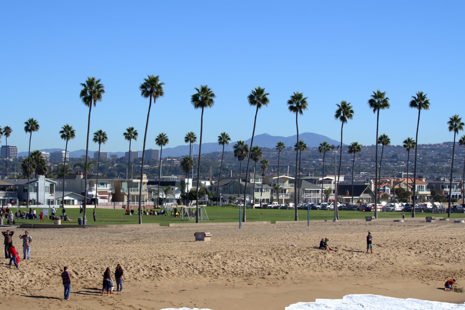
- 1888: McFadden Wharf, now the Newport Pier site
- 1906: the Pavilion, the Balboa Pier, and the Red Car to Balboa
- 1936: the Fun Zone and the finished West Jetty
Homes on the ocean side and the bay side
Small lots, and more duplexes than you'd expect.
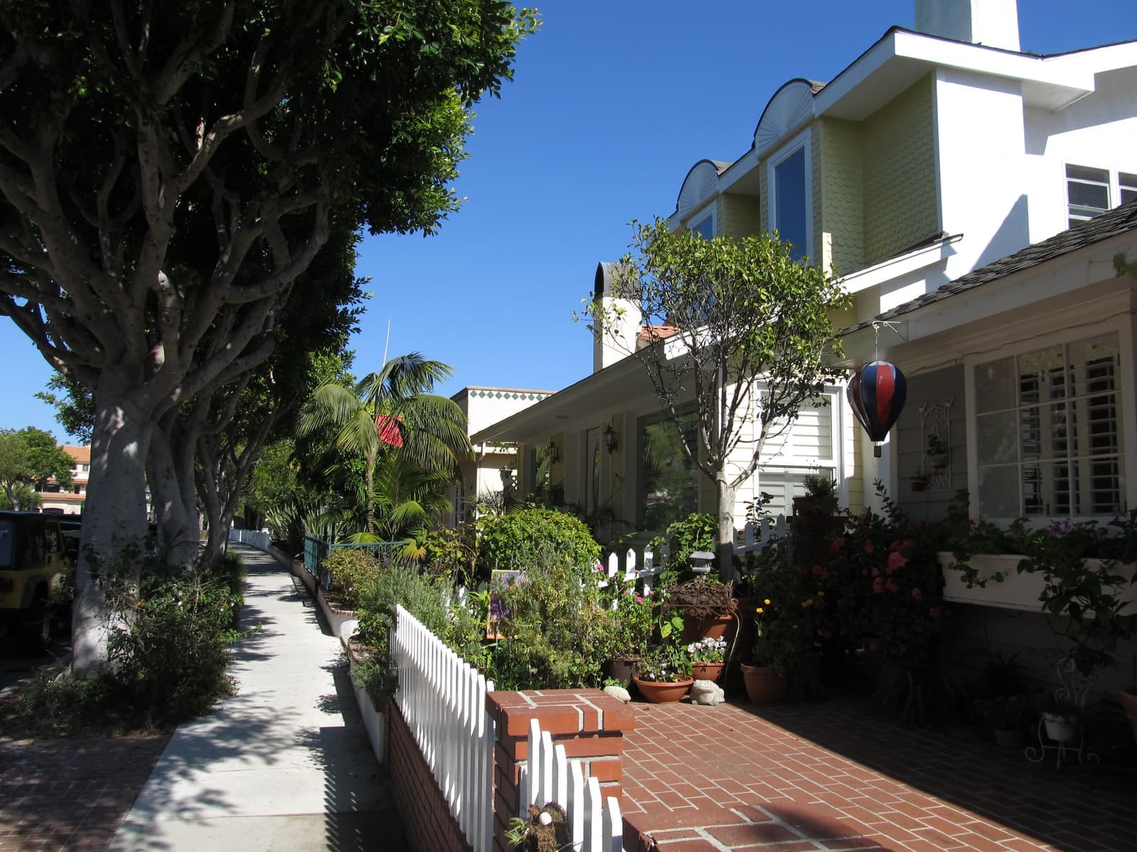
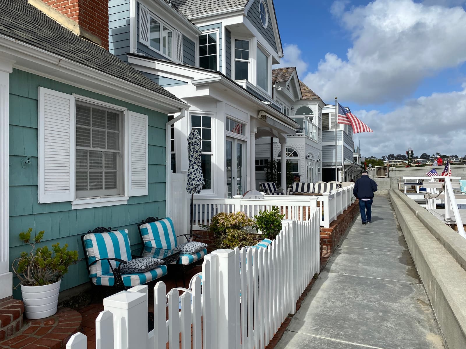
Most of the Peninsula is small lots packed close together, with cross streets running from the boardwalk to the bay. In the listings I pulled in late September 2026, lots mostly ran about 2,200 to 3,000 square feet and recorded build years ran from 1912 to 2025. So a 1920s cottage can sit next to a three-story rebuild that fills its lot to the setbacks.
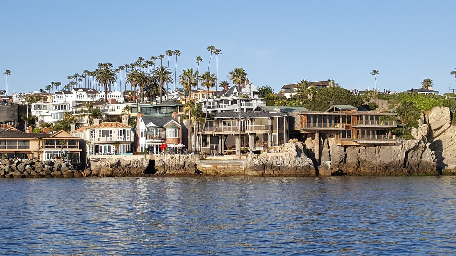
There are three kinds of addresses. Ocean-front houses face the boardwalk and the sand. Bay-front houses sit on the harbor, often with a private dock and a bulkhead, so ask early who owns and maintains the wall. In between are the inside blocks, a short walk from both waters.
Duplexes and small buildings are a big part of what's for sale. Of roughly 50 active listings in our mapped area in late September 2026, 24 were single-family houses asking from about $2.7 million to more than $50 million, most between $4 million and $11 million. Most of the rest were duplexes, triplexes, fourplexes, and mixed-use buildings, mostly asking $2.4 million to $6.2 million. A few buildings appear twice on the MLS, listed two different ways, so treat the counts as approximate.

- Lots of roughly 2,200 to 3,000 sq ft in current listings
- Ocean-front, bay-front, and inside blocks price very differently
- Many listings are two-to-four-unit buildings
The Peninsula's two waterfronts
Big surf breaks at the Wedge, and the calmer harbor side has the ferry and the boats.
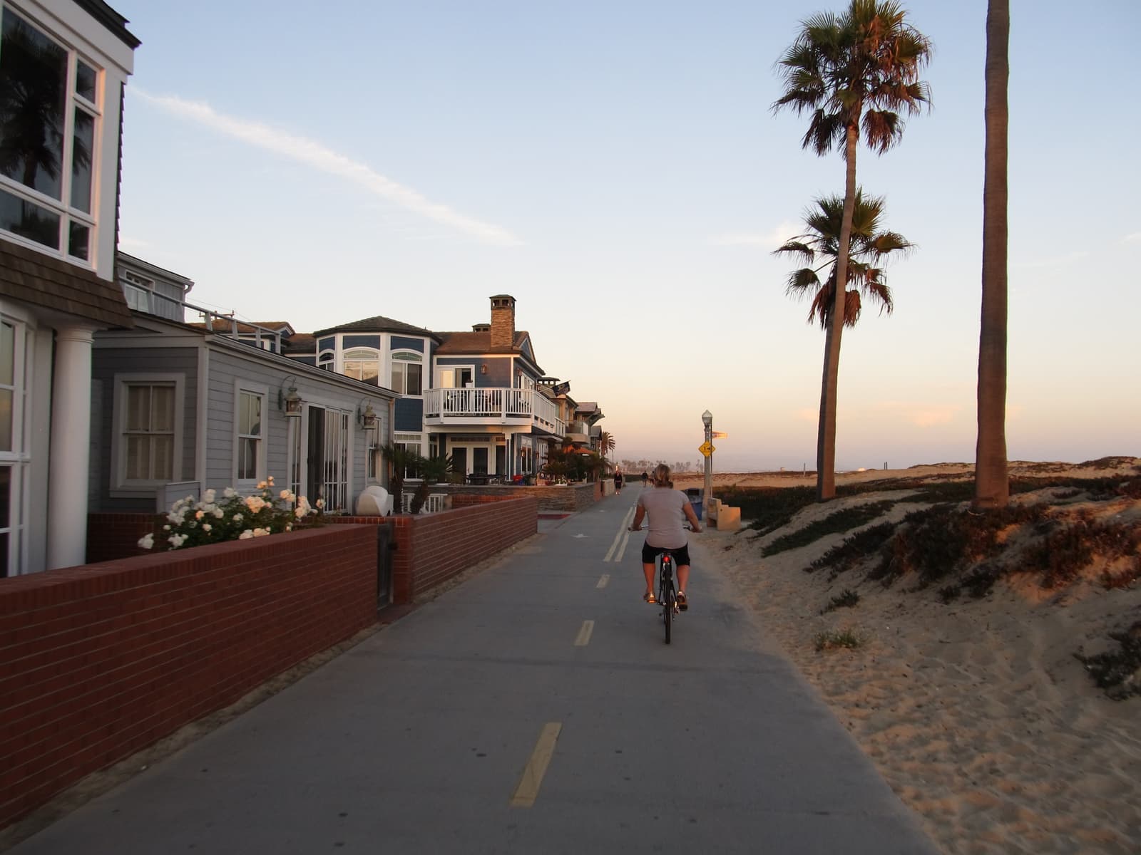
The ocean beach runs the whole length of the Peninsula, and a boardwalk follows it for 2.9 miles, from 36th Street to near E Street. People walk and ride it, and fish off both piers.
The Wedge is at the very end, beside the West Jetty. When a big south swell arrives, waves reflect off the jetty and stack onto the next set, and the peaks can reach 30 feet and break in a few feet of water. It draws bodysurfers, bodyboarders, and crowds of spectators on the sand. Lifeguards there warn visitors before they get in the water, and for most people watching is the right call.
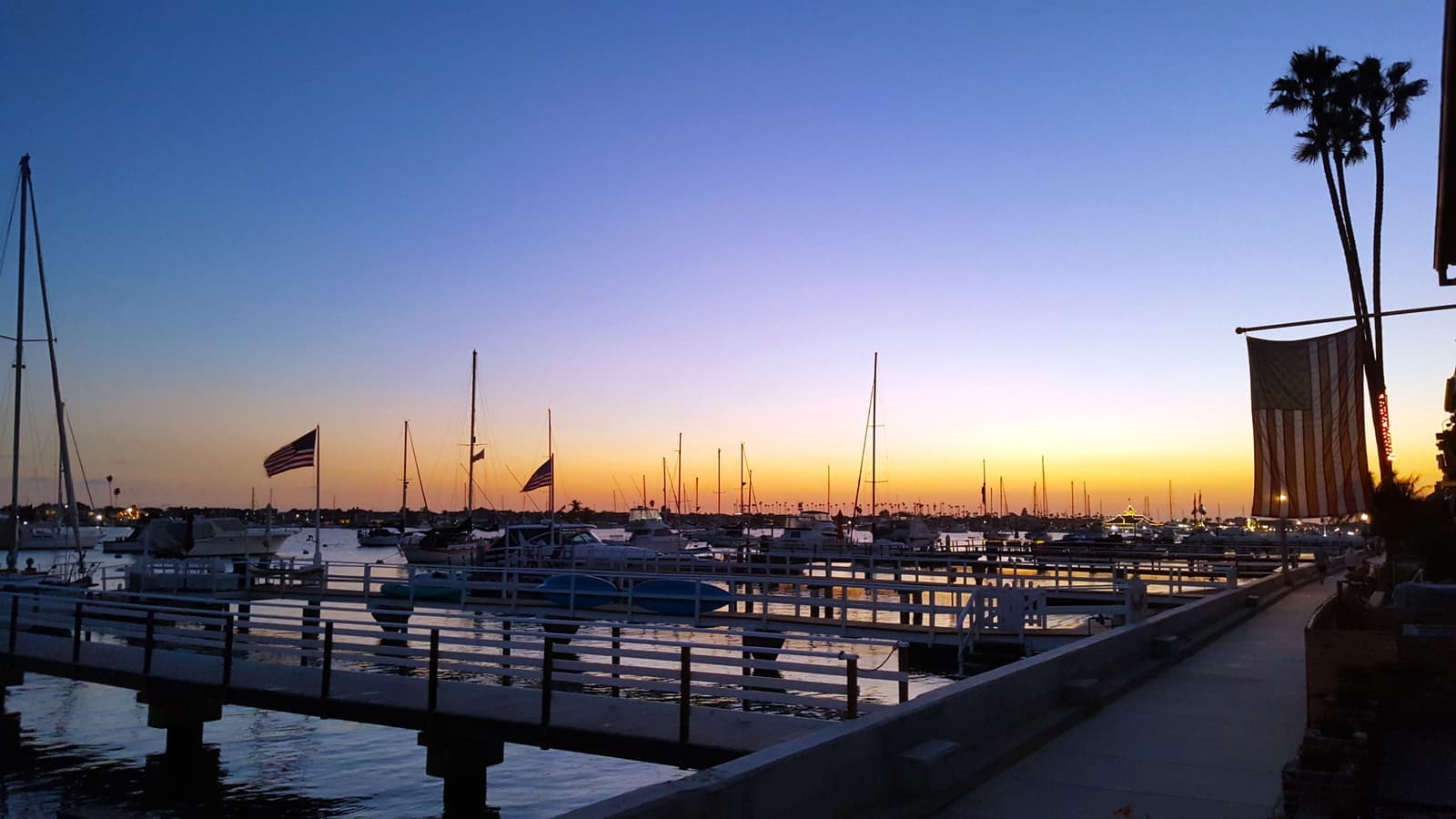
The harbor side is calmer. Balboa Village has the Pavilion, the Fun Zone and its Ferris wheel, harbor cruises, and the Catalina Flyer to Avalon. The Balboa Island Ferry has run from Palm Street since 1919, carrying three cars at a time across about 800 feet of water, and it's the quick way to Marine Avenue. Marina Park, the city park and community center on the bay at 1600 West Balboa Boulevard, is the calm-water spot on that side.
Food is casual. The Crab Cooker has served seafood on Newport Boulevard since 1951 and reopened in a rebuilt building in 2021, and Alta Coffee sits on 31st Street in Cannery Village.
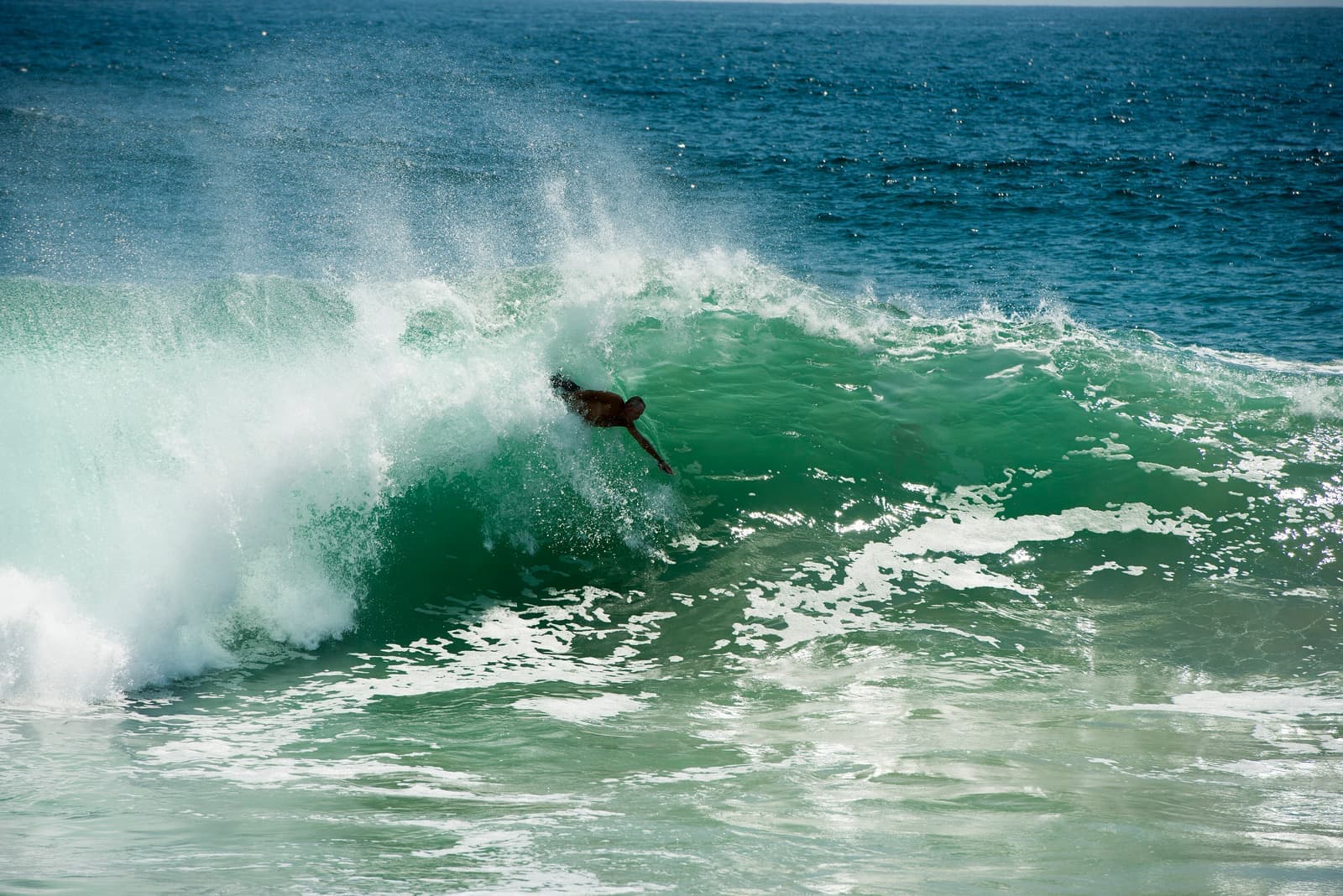
- A 2.9-mile boardwalk along the ocean beach
- The Wedge: waves up to 30 feet on big south swells
- The ferry to Balboa Island has run from Palm Street since 1919
Parking and getting around in summer
The Peninsula is two different places, one in July and one in February.
Only two roads connect the Peninsula to Coast Highway, Newport Boulevard and West Balboa Boulevard, and in summer both carry beach traffic. The city runs a free trolley on summer weekends specifically to cut down on people circling for parking. In 2026 the Balboa Peninsula Trolley ran Saturdays and Sundays from May 23 to September 7, from 10 a.m. to 9:30 p.m., with 22 stops and a trolley about every 15 minutes. Riders park at the Avon Street lot in Mariners' Mile and ride down.
Parking is paid and tight. The Balboa Pier lot at Palm Street and Balboa Boulevard has 614 spaces and charges around the clock: $4.50 an hour from May through September, $3.10 from October through April, and $6.20 on Memorial Day, the Fourth of July, and Labor Day. Most other city meters run from 8 a.m. to 6 p.m. every day. Balboa Village residents and patrons can get a permit for two free hours in public spaces there, and the city sells an overnight permit for the Balboa municipal lot.
A few beach rules surprise newcomers. Dogs aren't allowed on the beach or the beachfront walks from 10 a.m. to 4:30 p.m., glass and alcohol are banned on the sand, and the fire rings are near the Balboa Pier, open 6 a.m. to 10 p.m.

- Free summer-weekend trolley with 22 stops
- Balboa Pier lot: 614 spaces, paid 24 hours a day
- No dogs on the beach from 10 a.m. to 4:30 p.m.
Flood risk and the property line on the sand
The ground is low, and the sand out front is public.
The Peninsula is low, and the city says so in its own hazard plan. The 2014 plan notes that local flooding of streets, businesses, and homes along the Peninsula isn't unusual when storm surge, wind, and high tide line up, as they did in January 2005. City crews close some tide valves when tides are forecast above 5.2 feet and all 86 valves in the city above 7 feet.
Flood insurance depends on the block. FEMA's current maps took effect March 21, 2019. When I checked points across the Peninsula, the sand was zone VE, most houses in the middle fell in shaded zone X (the 0.2 percent annual chance area), and some harbor-side blocks, including ones east of the Pavilion and in Cannery Village, were zone AE with a base flood elevation of 8 feet. A federally backed mortgage requires flood insurance in AE and VE, so get the zone for the exact parcel.
The whole Peninsula sits inside California's tsunami hazard area. Every point I checked on the state's map, from Cannery Village to Peninsula Point, came back inside the zone. Learn the walking route off the sandspit before you need it.
The beach in front of the ocean-front houses is public, and the Coastal Commission enforces that. In June 2020 it approved $1.7 million in combined fines for 33 homeowners at Peninsula Point whose lawns, patios, and fences had spread as far as 80 feet onto the city-owned beach. If a house you like has a yard past its property line, ask for the survey and the permits before you count that space as yours.
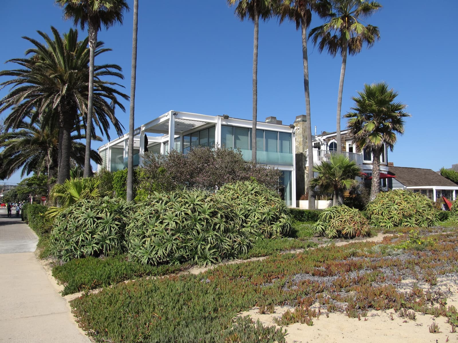
- Flood zones range from X to AE and VE; check the parcel
- Every point I checked is in the state tsunami hazard area
- The sand is public; encroachments have drawn six-figure fines
What I check before you buy on the Peninsula
The questions that change the math on a Peninsula purchase.
Short-term rentals need a city short-term lodging permit and a business license, and new ones have been banned in single-family (R-1) zones since 1992, with a small number of older permits grandfathered. Newport caps permits at 1,550 citywide and keeps a wait list for new ones. Most permits are in a few beach areas: in 2017, all but nine of the city's roughly 1,070 permits were in West Newport, the Balboa Peninsula, Balboa Island, and Corona del Mar.
Schools are Newport-Mesa Unified. The district's boundary maps put the Peninsula in the Newport Elementary area, and the school itself is on the Peninsula at 1327 West Balboa Boulevard. For older grades the Peninsula is in the Ensign Middle School and Newport Harbor High School attendance area. Boundaries change, so confirm the address with the district's school locator.
On a Peninsula purchase I start with the flood zone and an elevation certificate, then the survey: where the property line sits on the ocean side, and on the bay side, the dock permit and the condition and ownership of the bulkhead. If rental income is part of the plan, I check the zoning and whether a short-term permit already exists, since a new one means the wait list. And I walk the block on a July Saturday, because that's when you learn about noise and parking. I do all of this in English or Russian.
- Short-term rentals: city permit, 1,550 cap, none in R-1 zones
- Newport Elementary, Ensign Middle, Newport Harbor High
- Survey, dock, bulkhead, and flood zone before the offer
More Balboa Peninsula facts
- 1906Pavilion and pier builtThe year the Red Car reached Balboa
- ~3.3 milesLength, 32nd St to the WedgeOcean on one side, harbor on the other
- 2.9 milesOcean-front boardwalk36th Street to near E Street
- Since 1919Balboa Island FerryAbout 800 feet across the harbor
- 1,550Short-term lodging capPermits citywide, with a wait list
- YesTsunami hazard areaEvery point I checked on the state map






Rentals in Balboa Peninsula
50 active rentals in the mapped area
$3,495/mo
Quadruplex1 bd1 ba610 sqft
1116 W Balboa Boulevard D
$3,950/mo
Apartment2 bd1 ba1,084 sqft
514 W Balboa
$3,000/mo
Apartment1 bd1 ba420 sqft
311 E Edgewater B
$11,995/mo
Single-Family4 bd4 ba3,000 sqft
2025 E Balboa
$21,995/mo
Single-Family4 bd4 ba2,672 sqft
1214 E Balboa Boulevard
$14,000/mo
Duplex3 bd3 ba2,000 sqft
2214 W Oceanfront B
$12,000/mo
Duplex3 bd2 ba1,300 sqft
2214 W Oceanfront A
$25,000/mo
Single-Family4 bd6 ba3,649 sqft
1554 E Oceanfront
$9,800/mo
Condo4 bd2 ba1,739 sqft
2600 Newport Blv 310
$25,000/mo
Single-Family3 bd4 ba3,669 sqft
1228 W Oceanfront
$9,995/mo
Condo3 bd2 ba1,600 sqft
2600 Newport 11
$5,000/mo
Duplex2 bd1 ba1,000 sqft
207 Cypress A
$4,250/mo
Quadruplex1 bd1 ba500 sqft
1128 W Balboa Blvd
$10,000/mo
Single-Family3 bd3 ba1,834 sqft
2104 E Ocean
$8,300/mo
Duplex3 bd2 ba1,352 sqft
3010 W Oceanfront Upper "B"
$25,000/mo
Single-Family4 bd6 ba3,316 sqft
1508 E Balboa Boulevard

Questions & answers
The Balboa Peninsula is the sandspit in Newport Beach between Newport Harbor and the Pacific Ocean. It runs a little over three miles from Cannery Village and the Newport Pier east to the Wedge at the harbor entrance. Cars reach it on Newport Boulevard and West Balboa Boulevard, and the Balboa Island Ferry connects it to Balboa Island across the harbor.
Explore near Balboa Peninsula
0.9 mi awayBalboa IslandA dredged-up island in Newport Harbor, with cottages on 30-foot lots and a car ferry that's run since 1919Read the guide ›2.1 mi awayCorona del MarThe bluff-top village at the harbor mouth, where the Flower Streets run down to two beachesRead the guide ›4.4 mi awayNewport CoastThe Irvine Company's gated hillside villages, built in the 1990s and 2000s above Crystal Cove State ParkRead the guide ›6.3 mi away · IrvineTurtle RockIrvine's first hillside village, started in 1967, with two elementary schools inside and Bommer Canyon out the backRead the guide ›6.7 mi away · Huntington BeachDowntown Huntington BeachThe numbered streets around Main and the pier, the part of Surf City USA you can walkRead the guide ›6.9 mi away · IrvineUniversity ParkIrvine's first village, from the mid-1960s, where the houses face shared parks instead of the streetRead the guide ›
Where we check the facts
The facts in this guide (districts, zones, rules) come from the official records below. We re-check them before property tours.
- City of Newport Beach: parking lots and ratesnewportbeachca.govBalboa Pier lot, rates, meter hours
- City of Newport Beach: parking permitsnewportbeachca.govBalboa Village and overnight permits
- City of Newport Beach: Balboa Peninsula Trolleynewportbeachca.gov2026 schedule and stops
- City of Newport Beach: beach informationnewportbeachca.govdog hours, fire rings, beach rules
- City of Newport Beach: Natural Hazards Mitigation Plan (2014), floodsnewportbeachca.govtide valves and Peninsula flooding
- City of Newport Beach: FEMA flood map changesnewportbeachca.govmap effective date
Show all 17 sourcesShow fewer
- FEMA Flood Map Service Centermsc.fema.govflood zones by address
- California Geological Survey: tsunami hazard area mapsconservation.ca.govtsunami hazard area
- California Coastal Commission: Newport Beach LCP amendment, short-term lodging (Oct 2021)documents.coastal.ca.govpermit cap, R-1 ban, where permits are
- City of Newport Beach: short-term lodgingnewportbeachca.govpermit and license requirement
- Orange County Register: Coastal Commission approves $1.7 million in fines (June 2020)ocregister.comPeninsula Point beach encroachments
- Newport-Mesa Unified School District: schools and boundary mapsweb.nmusd.usNewport Elementary, Ensign, Newport Harbor High
- Wikipedia: Balboa Pavilionen.wikipedia.org1906 construction and Red Car arrival
- Wikipedia: Newport Pieren.wikipedia.orgMcFadden Wharf, 1940 pier, landmark number, Dory Fleet
- Wikipedia: The Wedge (surfing)en.wikipedia.orgwave mechanics, 1936 jetty
- Balboa Island Ferrybalboaislandferry.comcrossing length and hours
- CRMLSgo.crmls.orgactive listings
Photo credits (8)
- Evening light on the Oceanfront boardwalk and its beach housesKen Lund, CC BY-SA 2.0
- Evening sun on the beach and Oceanfront homes, seen from the Newport PierPatrick Pelster, CC BY-SA 3.0 de
- Balboa Beach and the palms of Peninsula Park, with Saddleback on the skylineRob Faulkner (robef), CC BY 2.0
- The Ferris wheel at the Balboa Fun Zone, on the harbor side of the PeninsulaJeremy Thompson (Roller Coaster Philosophy), CC BY 2.0
- A bodysurfer inside a green wave at the Wedge, at the tip of the PeninsulaSkiEngineer, CC BY-SA 4.0
- Palm-lined Main Street in Balboa Village, seen from the Balboa Pier on a summer morningprayitnophotography (Flickr display name: Thank You (25 Millions ) views), CC BY 2.0
- Aloes and ice plant on the sand in front of oceanfront homes near Peninsula PointKen Lund, CC BY-SA 2.0
- A cottage garden behind a white picket fence on a quiet block near the WedgeKen Lund, CC BY-SA 2.0