




Brentwood asks 3.6 times as much as Los Angeles does as a whole.
Los Angeles, California · Neighborhood guide
Brentwood
Canyon houses above Sunset and big-lot streets below it, on the west side of the 405
Median askingBrentwood$4.34M226 for sale
See homesBrentwood, in short.
Brentwood is a Westside neighborhood of the City of Los Angeles, between the 405 and the West LA VA campus on the east and Santa Monica and Pacific Palisades on the west, running from around Wilshire Boulevard north into the Santa Monica Mountains. The Los Angeles Times' Mapping L.A. boundary covers 15.2 square miles, and county records there show about 6,500 houses and 3,700 condo units. North of Sunset it's canyons and ridges such as Mandeville Canyon and Crestwood Hills; to the south are Brentwood Park, Brentwood Glen, Brentwood Village and the coral-tree median on San Vicente. In late September 2026, houses were listed from about $1.9 million to $70 million and condos from about $390,000 to $4 million.
Brentwood by the numbers.
- 33,341Population
- 52%Homeowner-occupiedoccupied homes
- 81%Bachelor's degree or higherage 25+
- $10,375/moMedian asking rentCurrent MLS listings
- $184,060Median household income
- 41.2Median age
Sources: U.S. Census Bureau, ACS 5-year 2019–2023; neighborhood facts compiled by The Slava House.
A canyon half and a flat half, split by Sunset
Where Brentwood starts and stops, and how different its parts are.
Brentwood is part of the City of Los Angeles, not a city of its own. This guide uses the Los Angeles Times' Mapping L.A. boundary: the 405 and the West LA VA campus on the east, the Santa Monica city line and Pacific Palisades on the west, and the Santa Monica Mountains north to Mulholland Drive. That's 15.2 square miles, and Mapping L.A. counted 31,344 residents there in the 2000 census. A few streets on the western edge, such as Romany and Ravoli drives, fall inside that boundary but carry Pacific Palisades mailing addresses.
Sunset Boulevard divides it. North of Sunset, Brentwood is canyons and ridges: Mandeville Canyon, Kenter Canyon, the midcentury streets of Crestwood Hills, and the Getty on its hilltop by the 405. South of Sunset the land flattens out into Brentwood Park, Brentwood Glen along the freeway, Brentwood Village at Sunset and Barrington, and the San Vicente corridor with its restaurants and coral trees. Below San Vicente, toward Wilshire, most of the housing is condos and apartments.
County parcel records inside the boundary show about 6,500 houses, about 3,700 condo units, and about 390 apartment buildings with five or more units, roughly 6,000 apartments in all. The median house lot is about 12,700 square feet, and the median recorded build year is 1956. Century City is about 5 miles from Brentwood Village by car.
Live from the MLS
Brentwood compared with all of Los Angeles.
A square foot in Brentwood costs 87% more than across Los Angeles.
Brentwood$1,233
All of Los Angeles$660
Listings in Brentwood have been on the market about as long as across Los Angeles.
What’s for sale
66% of the homes for sale in Brentwood are single-family houses.
- Single-family66%149 homes
- Condo31%70 homes
- Townhouse2%5 homes
- Multi-unit1%2 homes
Homes for sale in Brentwood are 76% bigger than across Los Angeles.
Brentwood3,248 sq ft
All of Los Angeles1,850 sq ft
Each card sets the median in Brentwood against all of Los Angeles. The arrow on a card lists every Los Angeles neighborhood we cover. Asking prices for homes on the market right now inside each mapped area, not sale prices. Updated October 3, 2026, 5:00 PM PT
Homes for sale in Brentwood
226 active listings in the mapped area
$699,900
Condo1 bd1 ba1,098 sqft
11970 Montana Avenue 308
$1,900,000
Condo3 bd4 ba1,952 sqft
11715 Chenault Street PH1
$4,375,000
Single-Family4 bd5 ba3,145 sqft
11380 Waterford St
$5,995,000
Single-Family5 bd6 ba4,351 sqft
509 S Gretna Green Way
$1,095,000
Condo3 bd3 ba1,473 sqft
11820 Mayfield Avenue 105
$3,375,000
Single-Family5 bd3 ba2,596 sqft
600 Hanley Place
$2,999,000
Single-Family4 bd3 ba2,821 sqft
11344 Homedale Street
$929,000
Condo2 bd2 ba1,443 sqft
500 S Barrington Avenue 6
$3,995,000
Single-Family4 bd4 ba3,535 sqft
12408 W Sunset Boulevard
$29,950,000
Single-Family6 bd8 ba9,316 sqft
223 N Carmelina Avenue
$1,120,000
Condo2 bd2 ba1,322 sqft
11928 Kiowa 105
$1,300,000
Condo2 bd3 ba1,408 sqft
11982 Kiowa Avenue 307
$3,599,500
Single-Family4 bd5 ba4,856 sqft
12699 Promontory Road
$5,995,000
Single-Family4 bd5 ba3,768 sqft
13176 Boca De Canon Lane
$16,774,500
Single-Family6 bd7 ba10,595 sqft
2041 Mandeville Canyon Road
$1,850,000
Condo3 bd4 ba2,066 sqft
11715 Chenault Street 204

Still deciding? Ask me.
I’m a Realtor based in Long Beach, and Los Angeles is one of the cities I work most. Tell me what you’re after in Brentwood and I’ll help you get there.
Slava Ploshkin · DRE #02323623English and Russian · How I work in Los Angeles
Where to eat, shop, and explore in Brentwood
The restaurants, cafes, shops, parks, and landmarks that give Brentwood its everyday character, most within a short walk.
8 places
Pick one and I’ll show you where it is.
Park1 hr walk
The coral trees down the median of San Vicente Boulevard between 26th Street and Bringham Avenue, a Los Angeles Historic-Cultural Monument (No. 148) since March 3, 1976.
Landmark25 min walk
Richard Meier's museum campus on a 110-acre hilltop above the 405, open since 1997. Admission is free with a timed reservation.
Parking is $25, $15 after 3 p.m., and free after 6 p.m. on Saturdays. It's closed Mondays.
Shopping1 hr walk
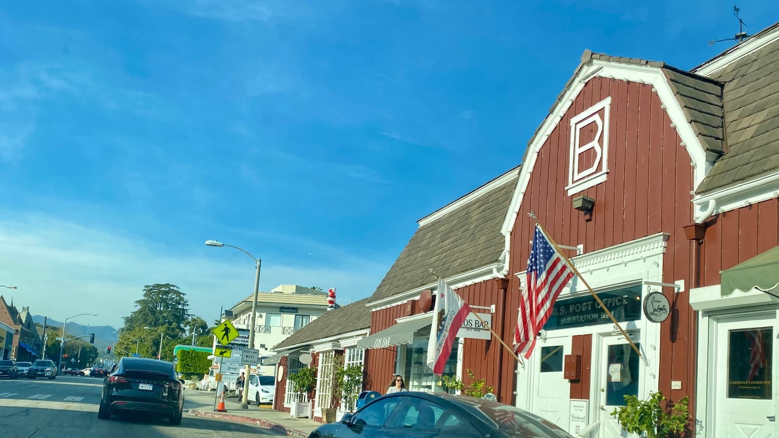
The barn-style market at 26th Street and San Vicente, open since 1948 and designed by Rowland Crawford, with shops and food stalls around a courtyard.
Its mailing address is Santa Monica, 225 26th Street, right on the city line.
Restaurant45 min walk
The small shopping streets at Sunset and Barrington, with restaurants and cafes along Barrington Court and Barrington Avenue.
Coffee1 hr 5 min walk
A coffee bar on the San Vicente restaurant stretch near Barrington; there's another one at the Country Mart.
Shopping1 hr walk
An independent grocery on San Vicente Boulevard, facing the coral-tree median.
Park15 min walk
The park the Mutual Housing Association set aside when it planned Crestwood Hills in the late 1940s, now owned by the city, at 1000 Hanley Avenue.
Recreation50 min walk
The city recreation center on South Barrington Avenue, south of Brentwood Village.
The neighborhoods inside Brentwood
Brentwood Park, the Glen, Crestwood Hills, and the canyons differ enough that I search each one separately.
Brentwood Glen is the small-lot grid between Sunset, the 405 and the VA campus. County records there show about 350 houses on lots of roughly 5,300 square feet, with a median recorded build year of 1945. The freeway is the downside, and you'll hear it on the streets closest to it.
Crestwood Hills started in 1946, when four musicians formed a housing cooperative that grew to 400 members as the Mutual Housing Association. It bought 800 acres in the hills and hired architects A. Quincy Jones and Whitney R. Smith and engineer Edgardo Contini, who drew 29 house plans in concrete block, redwood and glass. The group's guidelines kept houses to one story from the street so the lots below kept their views. Today 20 houses on Crestwood Hills streets and the association's old site office are city Historic-Cultural Monuments, three of the houses designated in November 2025.
The canyons are where the big lots are. Around Mandeville Canyon the median house lot is roughly 17,000 square feet, and the houses there sit along long canyon roads. South of Sunset, Brentwood Park fills much of the land between Sunset and San Vicente. Below San Vicente, east of Bundy, the house lots shrink to about 7,400 square feet, and condos and apartments outnumber houses.
- Brentwood Glen: about 350 houses on roughly 5,300-square-foot lots next to the 405
- Crestwood Hills: 1940s cooperative, 21 city monuments, one story from the street
- The canyons: the biggest lots, and Very High fire hazard
Brentwood's main streets and the Getty
Coral trees line San Vicente Boulevard, and the Getty sits on its hilltop by the 405.
San Vicente Boulevard is Brentwood's main commercial street. The coral trees down its wide median, from 26th Street to Bringham Avenue, were declared Los Angeles Historic-Cultural Monument No. 148 on March 3, 1976. At the west end, the barn-style Brentwood Country Mart has been open since 1948; its buildings were designed by Rowland Crawford, and its mailing address is actually Santa Monica. The restaurants, cafes and grocery stores sit along San Vicente between Bundy and Barrington.
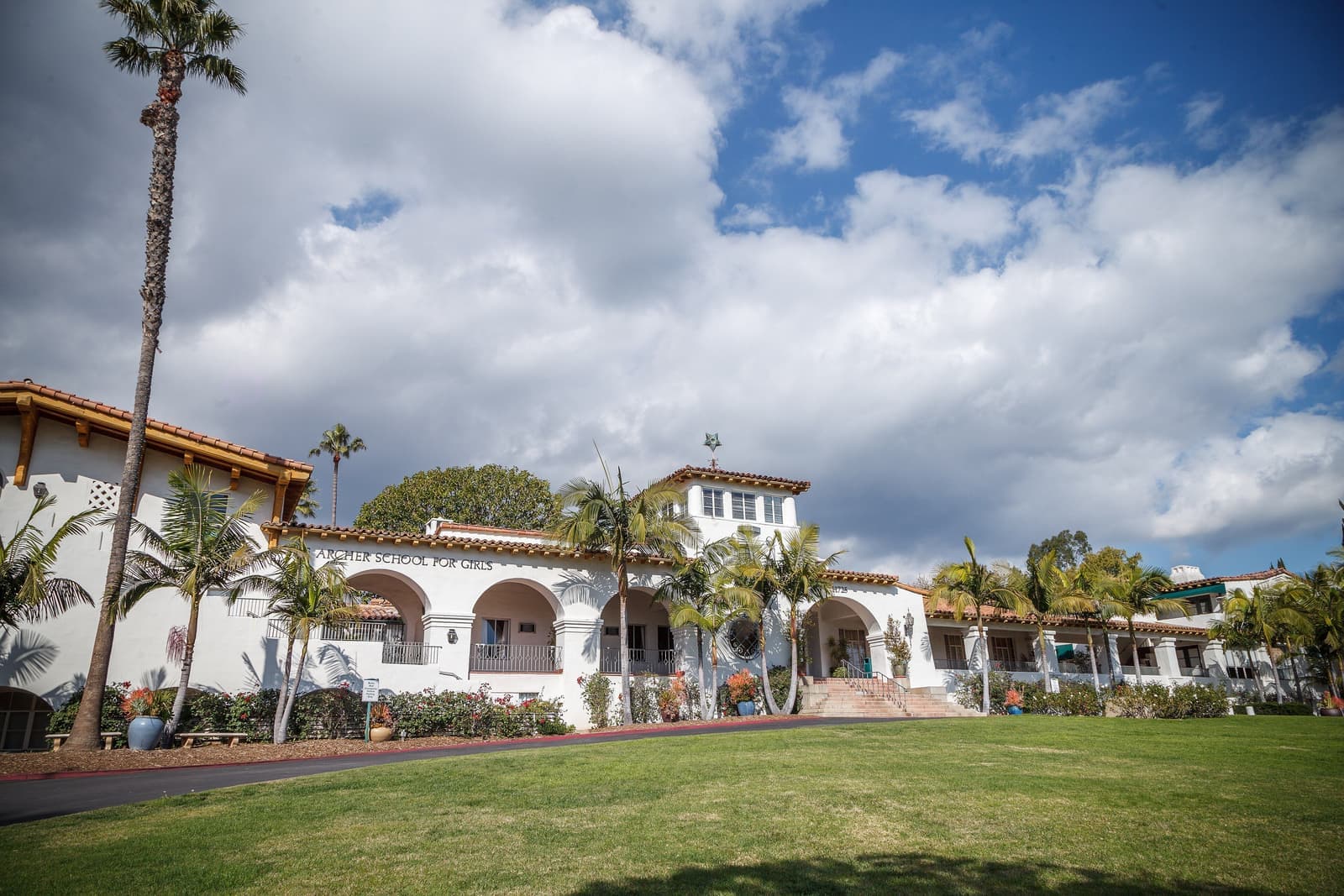
Brentwood Village is the smaller cluster at Sunset and Barrington, with restaurants and cafes on Barrington Court. Nearby on Sunset, the Archer School for Girls occupies the former Eastern Star Home, Historic-Cultural Monument No. 440, and Brentwood School has its K-5 campus at 12001 Sunset and its 6-12 campus at 100 South Barrington Place.
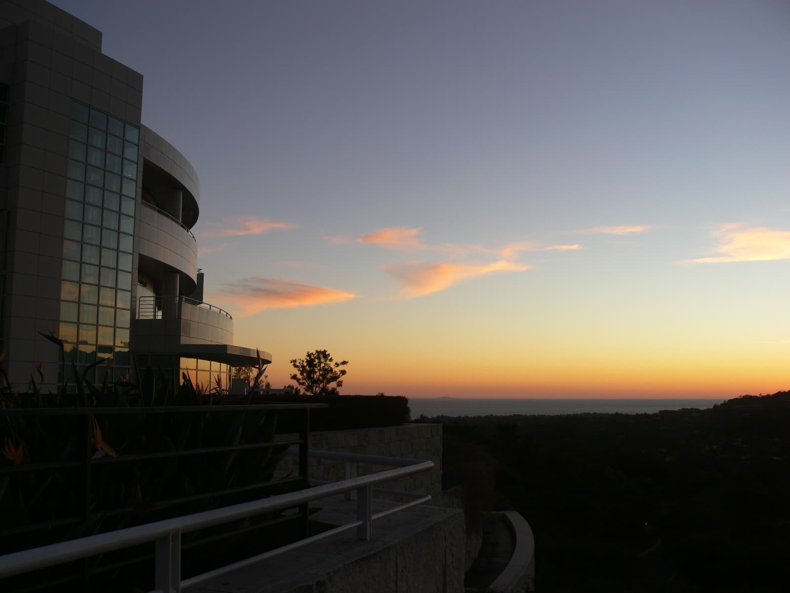
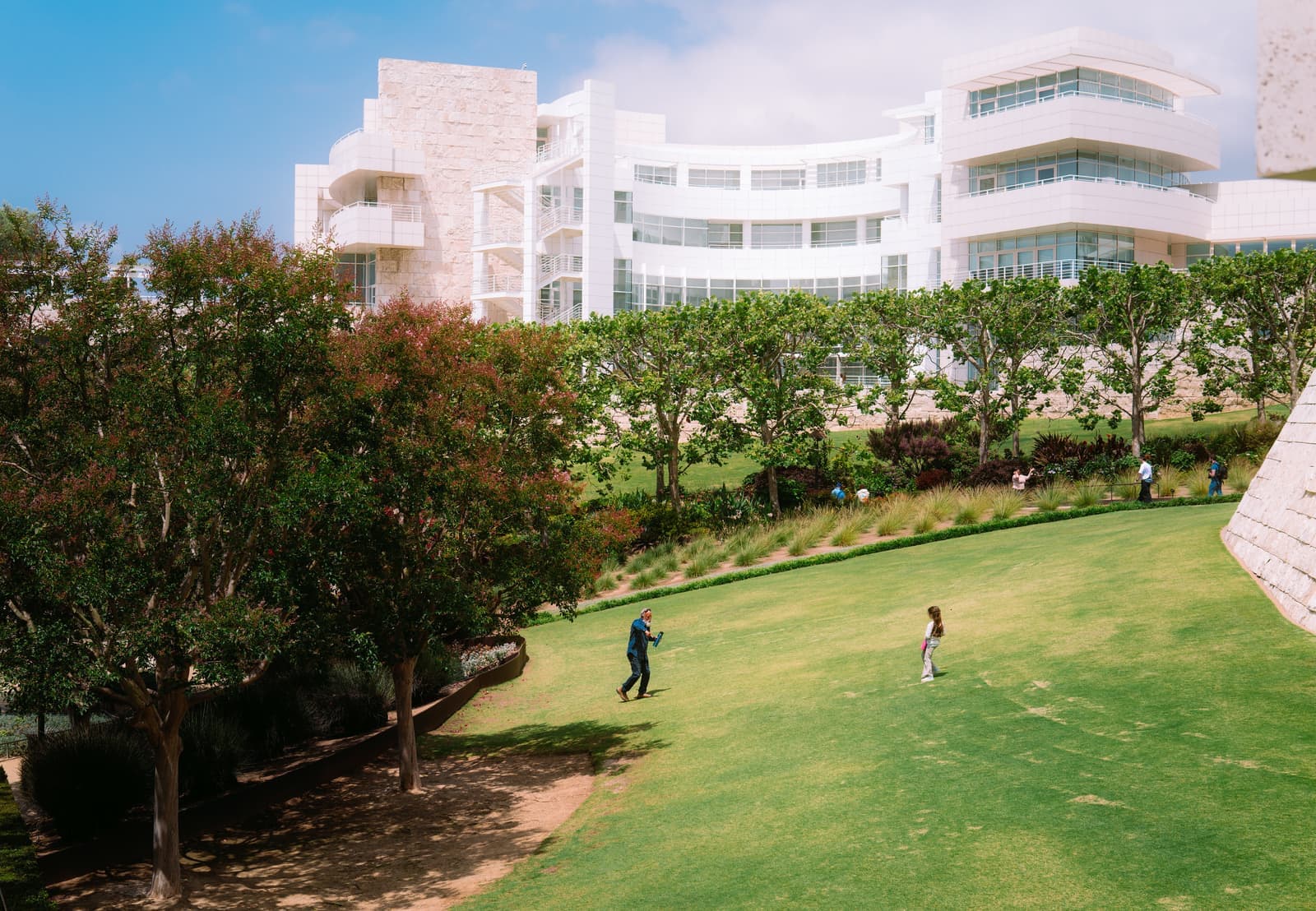
The Getty Center opened in 1997 on a 110-acre hilltop site designed by Richard Meier. Admission is free with a timed reservation, parking is $25 per car or $15 after 3 p.m., and the museum is closed Mondays and open until 9 p.m. on Saturdays. For people living nearby, it's a garden and a view you can reach in a few minutes; Brentwood Village is under a mile from its entrance.
- Coral trees on San Vicente: Historic-Cultural Monument No. 148 since 1976
- Brentwood Country Mart since 1948, with a Santa Monica address
- The Getty: free with a reservation, closed Mondays
The Getty and Palisades fires and the 2025 map
What has burned here, and why I get the insurance quote before the offer.
The Getty Fire started early on October 28, 2019, beside the 405 near the Getty Center. The Los Angeles Fire Department traced it to a tree branch that broke off in high winds and landed on power lines, which sparked and lit the brush. It burned 745 acres in the hills north of Sunset, destroyed 10 homes and damaged 15 more.
The January 2025 Palisades Fire reached Brentwood's western hills. CAL FIRE's damage inspection data records 23 structures destroyed inside the Mapping L.A. Brentwood boundary. Almost all were on the western edge around Romany Drive, Ravoli Drive, Evans Road and Alta Mura Road, streets with Pacific Palisades mailing addresses, and one was far up Mandeville Canyon Road. The fire's final perimeter covers about 2,600 acres of the boundary, all of it on the western side, around and west of Mandeville Canyon. After a flare-up in Mandeville Canyon on the night of January 10, 2025, the evacuation order ran from the ocean east to the 405 and south to San Vicente Boulevard, so most of Brentwood had to leave even though the burned area stayed around and west of Mandeville.
On CAL FIRE's 2025 fire hazard map for cities, about 89% of Brentwood's land is rated Very High. That includes the canyons, Crestwood Hills, Brentwood Village and parts of Brentwood Park. Brentwood Glen is mixed, Very High on Acari Drive, High and Moderate around Beloit Avenue and Farlin Street, and unzoned by the 405, while almost all of the land south of San Vicente is outside the hazard zones. In a Very High zone the Los Angeles Fire Department requires brush clearance within 200 feet of structures. The California FAIR Plan, which many owners in high-risk areas now depend on, covers fire only, caps a house at $3 million, and was approved for an average 29.1% rate increase on policies starting October 15, 2026. Get written quotes on the address first.
- Getty Fire, 2019: 745 acres, 10 homes destroyed, caused by a branch on power lines
- Palisades Fire, 2025: 23 structures destroyed inside the boundary, mostly on the west edge
- About 89% of the land is Very High fire hazard on the 2025 map
What Brentwood homes cost
Asking prices, and the transfer tax you'll pay when you sell.
In late September 2026, 142 houses were for sale inside the Mapping L.A. boundary, asking from about $1.9 million to $70 million. The middle half asked between about $4.5 million and $15.5 million, and the middle listing asked about $8.7 million. There were also 71 condos, asking from about $389,000 to $4 million with the middle one near $1 million, and five townhouses from about $1.2 million to $4 million. Eighteen of the listings carried Pacific Palisades addresses on the western edge.
Sales here pay the City of Los Angeles transfer tax under Measure ULA. For sales closing after June 30, 2026, it's 4% of the full price above $5.4 million and 5.5% at $10.9 million or more, on top of the city's base rate of 0.45%. Because it applies to the whole price, it shapes pricing just above both thresholds.
Building rules depend on the lot. Canyon lots in the city's mapped Hillside Area fall under the Baseline Hillside Ordinance, in effect since 2011, which limits floor area and height by slope and caps grading and hauling. The Crestwood Hills monuments add historic review to those specific houses. On any house, ask for the permit history and a geotechnical report on a hillside lot before you plan a remodel.
- September 2026: 142 houses from about $1.9 million to $70 million
- 71 condos from about $389,000 to $4 million
- Measure ULA: 4% above $5.4 million, 5.5% at $10.9 million or more
Schools and getting around
Your address picks the public school, and the 405 is how you leave.
Brentwood is in the Los Angeles Unified School District, and the assignment changes by address. When I checked public addresses in September 2026 with LAUSD's Resident School Identifier, every one was assigned to Paul Revere Charter Middle School. The elementary school came back as Kenter Canyon Elementary Charter, Canyon Charter Elementary or Brockton Avenue Elementary depending on the address, and the high school as Palisades Charter High School for addresses to the north and west, or University High School Charter along San Vicente and Barrington. Several addresses are also guaranteed a place at Brentwood Elementary Science Magnet if the family applies. Your own address is the only one that counts, so check it with the district.
Private schools are part of the neighborhood too, including Brentwood School's two campuses and the Archer School for Girls on Sunset.
The 405 runs along the whole eastern edge, and it's the main way north to the Valley and south toward LAX, about 12 miles from Brentwood Village. Metro's D Line subway extension is being built toward a VA Hospital station at Brentwood's eastern edge, as part of the section to Westwood that's still under construction.
- LAUSD: Paul Revere Charter Middle for every address I checked
- Elementary and high school assignments split by area
- A D Line station is under construction at the VA, on the east edge
What I check on a Brentwood house
The checks that differ between a canyon house and a flat-street house.
North of Sunset I start with fire. I check the parcel on the 2025 fire map, pull the CAL FIRE damage data for the street, look at the brush clearance and the roof, and get a written insurance quote before an offer. On canyon roads I also drive the evacuation route at rush hour.
On any hillside lot I ask for the geotechnical history and the permits for every addition, because the hillside ordinance makes some additions hard to rebuild. In Crestwood Hills I check whether the house is a designated monument. South of Sunset I focus on the school assignment for the exact address, freeway noise in the Glen, and HOA documents and reserves on condos.
Then the math on price, including Measure ULA if you might sell above $5.4 million later. My broker, Joe Goodman, works Brentwood deals with me.
- Fire map, damage data, brush clearance, and an insurance quote
- Geotechnical reports and permit history on hillside lots
- Exact-address school assignment, freeway noise, and HOA reserves
More Brentwood facts
- 15.2 sq miAreaMapping L.A. boundary, the 405 to the Palisades
- ~6,500HousesCounty parcel records; median lot about 12,700 sq ft
- ~3,700Condo unitsPlus about 390 apartment buildings
- No. 148Coral trees monumentSan Vicente median, declared in 1976
- 21Crestwood Hills monumentsCity Historic-Cultural Monuments, three added in 2025
- ~89%Very High fire zoneShare of land on CAL FIRE's 2025 map





Rentals in Brentwood
100 active rentals in the mapped area
$22,500/mo
Single-Family4 bd3 ba3,000 sqft
2419 Banyan Drive
$35,000/mo
Single-Family5 bd5 ba4,633 sqft
2528 Westridge Road
$8,995/mo
Single-Family4 bd3 ba1,859 sqft
3493 Mandeville Canyon Road
$45,000/mo
Single-Family5 bd7 ba5,489 sqft
809 Leonard Road
$3,695/mo
Condo2 bd2 ba1,000 sqft
11959 Dorothy Street 2
$4,999/mo
Condo2 bd2 ba1,063 sqft
612 S Barrington Avenue 213
$6,495/mo
Condo3 bd3 ba1,319 sqft
900 S Westgate PH4
$8,800/mo
Single-Family3 bd3 ba1,883 sqft
300 N Bowling Green Way
$8,200/mo
Condo2 bd3 ba1,837 sqft
12234 Montana Avenue 402
$3,695/mo
Condo1 bd2 ba920 sqft
1000 S Westgate Avenue 210
$3,650/mo
Condo1 bd1 ba1,019 sqft
11636 Montana Avenue 302
$12,000/mo
Single-Family3 bd3 ba2,405 sqft
967 Wellesley Avenue
$7,750/mo
Single-Family3 bd3 ba1,518 sqft
650 LORNA Lane
$8,500/mo
Single-Family3 bd3 ba2,615 sqft
3452 Mandeville Canyon Road
$89,995/mo
Single-Family8 bd10 ba13,511 sqft
12730 Hanover Street
$6,700/mo
Condo1 bd1 ba890 sqft
11600 Dunstan Way 101
Renting in Brentwood
About $5,500 a month for a typical condo and $19,900 for a typical house, based on active listings in late September 2026. That month 102 rentals were listed inside the Mapping L.A. boundary: 26 condos with the middle half asking about $3,950 to $6,750, 11 apartments with the middle one at $5,750, and 60 houses with the middle half asking about $11,750 to $48,000.
Compare Brentwood
Compare Brentwood with another neighborhood

Questions & answers
Brentwood is a neighborhood of the City of Los Angeles on the Westside, between the 405 and the West LA VA campus on the east and Santa Monica and Pacific Palisades on the west. The Mapping L.A. boundary runs from around Wilshire Boulevard north to Mulholland Drive and covers 15.2 square miles. It isn't a separate city, so city services, zoning and taxes are those of Los Angeles.
Explore near Brentwood
3.5 mi away · Santa MonicaNorth of MontanaSanta Monica's single-family streets between Montana Avenue and the canyon rim, from Ocean Avenue to 26th StreetRead the guide ›4.9 mi away · Beverly HillsThe Beverly Hills FlatsCurving 1906 streets between Santa Monica Boulevard and Sunset, each planted with its own kind of treeRead the guide ›5.2 mi away · Santa MonicaSunset Park1930s and 40s houses between Pico Boulevard and Santa Monica Airport, with Clover Park in the middleRead the guide ›5.2 mi awaySherman OaksHills south of Ventura Boulevard, ranch-house flats north of it, and the 405 down the west sideRead the guide ›5.6 mi away · Beverly HillsTrousdale EstatesMidcentury houses on graded hillside pads above Sunset, held to 14 feet so the views stay openRead the guide ›5.7 mi away · Santa MonicaOcean ParkSanta Monica's beach corner south of Pico Boulevard, with Main Street running through itRead the guide ›


Where we check the facts
The facts in this guide (districts, zones, rules) come from the official records below. We re-check them before property tours.
- FOX 11 Los Angeles: Palisades Fire spreads toward Encino, Brentwood (Jan. 11, 2025)foxla.comJanuary 10 flare-up and evacuation-order boundaries
- Los Angeles Times: Mapping L.A., Brentwoodmaps.latimes.comboundary, area, 2000 population
- Los Angeles City Planning: Historic-Cultural Monuments listplanning.lacity.govcoral trees, Eastern Star Home, Crestwood Hills houses
- Los Angeles Conservancy: Crestwood Hillslaconservancy.orgMutual Housing Association history and architects
- Getty: Visit the Getty Centergetty.eduadmission, hours, parking
- Getty: Historygetty.eduopening year, site, architect
Show all 21 sourcesShow fewer
- Brentwood Country Mart: Aboutbrentwoodcountrymart.com1948 opening, architect, address
- Los Angeles Fire Department: Getty Firelafd.orgcause, acreage, homes destroyed
- CAL FIRE: Palisades Firefire.ca.govacreage and dates
- CAL FIRE: 2025 Palisades damage inspection (DINS) dataservices1.arcgis.comstructures destroyed by location
- CAL FIRE: Fire Hazard Severity Zones, Local Responsibility Area (2025)services1.arcgis.comfire hazard zone by location
- Los Angeles Fire Department: Brush Clearance Requirementslafd.org200-foot clearance in Very High zones
- California Department of Insurance: FAIR Planinsurance.ca.govcoverage limits
- KQED: FAIR Plan 29.1% rate increasekqed.orgaverage increase and effective date
- City of Los Angeles Office of Finance: Measure ULAfinance.lacity.gov2026 thresholds and rates
- City of Los Angeles Ordinance 181,624 (Baseline Hillside Ordinance)cityclerk.lacity.orghillside floor area, height, grading, and hauling limits
- LAUSD Resident School Identifierrsi.lausd.netschool assignment by address
- Brentwood School: campusesbwscampus.comcampus addresses and grades
- Metro: D Line Extensionmetro.netSection 3 and the VA Hospital station
- Los Angeles County Assessorportal.assessor.lacounty.govhouse, condo and apartment counts, lot sizes, build years
- CRMLSgo.crmls.orgactive listings
Photo credits (8)
- Sunset from the Getty Research Institute, looking west past the Getty's buildings toward the oceanRemi Mathis, CC BY-SA 3.0
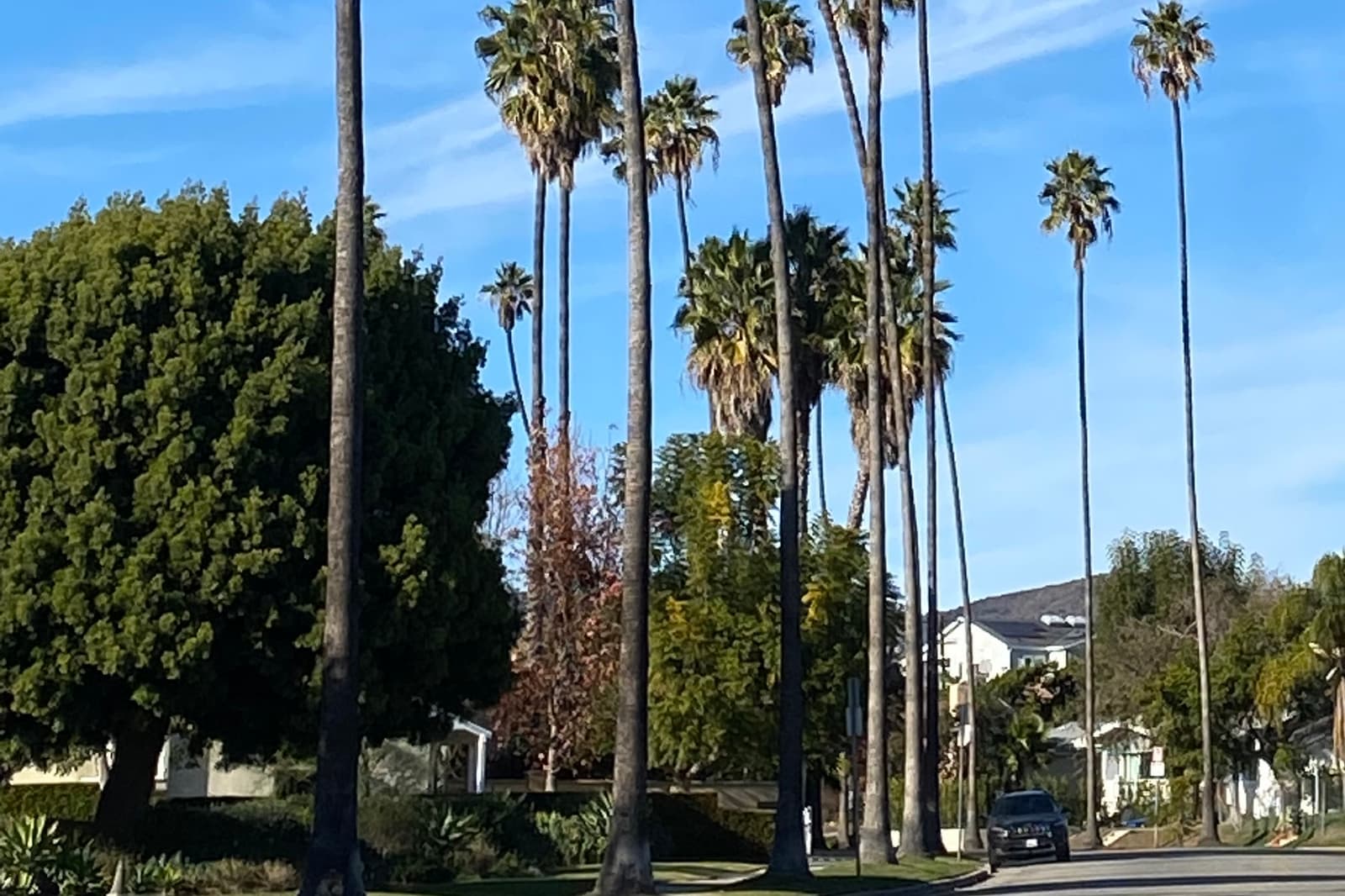
- Tall palms and old shade trees along Bundy Drive in BrentwoodJengod, CC BY-SA 4.0
- The Brentwood Country Mart at 26th Street and San Vicente, open since 1948Jengod, CC BY-SA 4.0
- The Getty Center seen from its garden lawn on a bright spring daySergiy Galyonkin, CC BY-SA 4.0
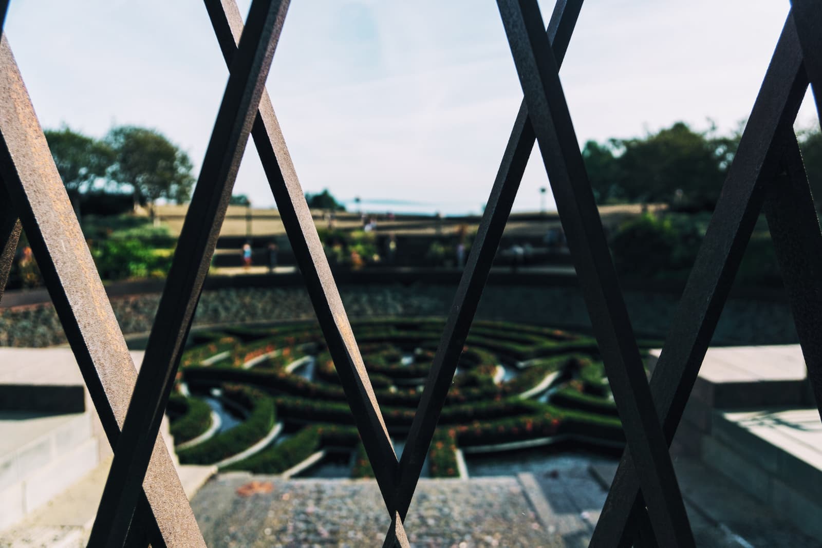
- The maze in the Getty's Central Garden, seen through a steel arborWil Stewart, CC0
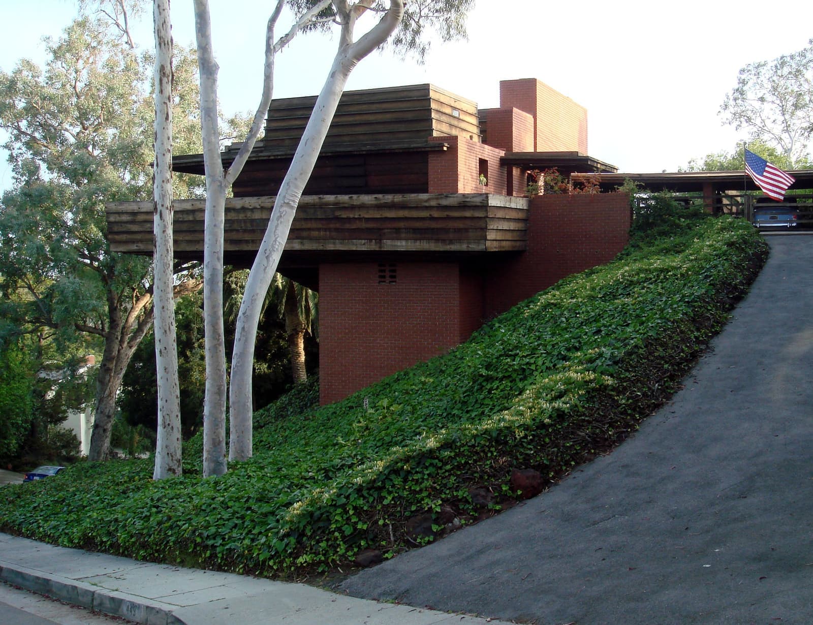
- Frank Lloyd Wright's 1939 Sturges House, cantilevered over its Brentwood hillsideBobak Ha'Eri, CC BY 3.0
- The Archer School for Girls on Sunset, in the former Eastern Star HomeTASFGComm, CC BY-SA 4.0
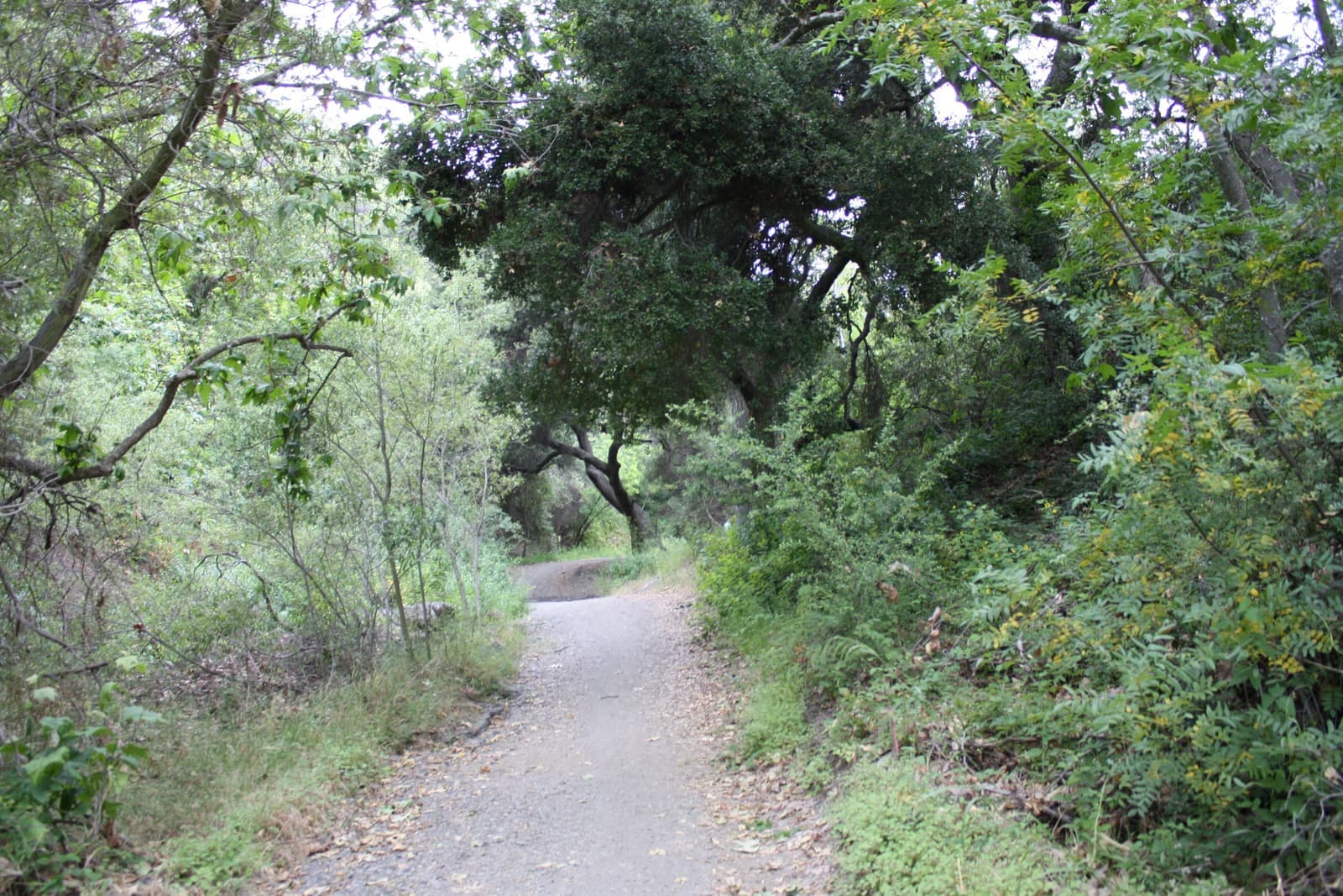
- Oaks and brush along the Sullivan Canyon trail, in the hills north of SunsetDavid Lofink, CC BY 2.0