





Sunset Park asks 11% less than Santa Monica as a whole.
Santa Monica, California · Neighborhood guide
Sunset Park
1930s and 40s houses between Pico Boulevard and Santa Monica Airport, with Clover Park in the middle
Median askingSunset Park$1.79M24 for sale
See homesSunset Park, in short.
Sunset Park is the southeastern part of Santa Monica, south of Pico Boulevard and east of Lincoln Boulevard, with Santa Monica Airport along its southern edge. It's mostly modest single-family houses: the county's records show about 2,600 of them, most on lots of 5,000 to 7,500 square feet and about 88% built between the 1920s and the 1950s, the 1940s above all. Under a 2017 consent decree with the FAA, the city can close the 192-acre airport after December 31, 2028, and it plans a park there. On September 25, 2026, houses listed here were asking about $2.0 million to $4.0 million.
Sunset Park by the numbers.
- 14,734Population
- 45%Homeowner-occupiedoccupied homes
- 69%Bachelor's degree or higherage 25+
- $3,800/moMedian asking rentCurrent MLS listings
- $127,736Median household income
- 41.6Median age
Sources: U.S. Census Bureau, ACS 5-year 2019–2023; neighborhood facts compiled by The Slava House.
Santa Monica's airport neighborhood
Where Sunset Park starts and stops, and what's inside it.
Sunset Park is the part of Santa Monica south of Pico Boulevard and east of Lincoln Boulevard, running to the city line with Los Angeles on the south and east. The city's neighborhood map gives this area to the Friends of Sunset Park. Santa Monica Airport fills the southeast corner, Santa Monica College's main campus sits at the northwest corner, and Clover Park is in between.
It's one of Santa Monica's two big single-family districts, with slightly more houses on the county's parcel map than North of Montana: about 2,600, plus about 3,150 apartment units and about 750 condo units. R1, the single-unit zone, covers about 54% of the zoned land inside our map, and R2 another 16%. Census numbers for the three tracts that make up the neighborhood show about 55% of households renting, against about 71% for Santa Monica as a whole.
Ocean Park Boulevard runs through the middle to the airport, with a short strip of cafes and a bakery around 17th Street and a shopping center near 29th. Pico Boulevard, the north edge, has more restaurants and the college.

Live from the MLS
Sunset Park compared with all of Santa Monica.
A square foot in Sunset Park costs 14% less than across Santa Monica.
Sunset Park$903
All of Santa Monica$1,045
Listings in Sunset Park have been on the market 15 fewer days than across Santa Monica.
What’s for sale
38% of the homes for sale in Sunset Park are single-family houses.
- Single-family38%9 homes
- Condo33%8 homes
- Multi-unit21%5 homes
- Townhouse8%2 homes
Homes for sale in Sunset Park are 6% smaller than across Santa Monica.
Sunset Park1,586 sq ft
All of Santa Monica1,685 sq ft
Each card sets the median in Sunset Park against all of Santa Monica. The arrow on a card lists every Santa Monica neighborhood we cover. Asking prices for homes on the market right now inside each mapped area, not sale prices. Updated October 4, 2026, 5:00 AM PT
Homes for sale in Sunset Park
24 active listings in the mapped area
$899,000
Condo2 bd2 ba960 sqft
827 Bay Street 5
$1,749,000
Condo4 bd4 ba2,266 sqft
2512 28th Street 110
$2,800,000
Single-Family3 bd2 ba2,077 sqft
1013 Bay Street
$1,000,000
Condo3 bd3 ba1,464 sqft
2325 20th Street 3
$1,825,000
Single-Family3 bd1 ba1,168 sqft
833 Wilson Place
$899,000
Condo2 bd2 ba1,398 sqft
2677 Centinela Avenue 203
$2,395,000
Single-Family3 bd2 ba1,600 sqft
2441 21st Street
$2,559,000
Multi-Family4 bd3 ba2,590 sqft
2252 20th Street
$1,199,000
Single-Family2 bd1 ba860 sqft
806 Navy Street
$1,555,000
Multi-Family5 bd4 ba1,940 sqft
2402 Ocean Park Boulevard
$815,000
Condo2 bd2 ba913 sqft
1021 Hill Street 2
$1,559,000
Townhouse2 bd3 ba2,020 sqft
2408 34th Street 4
$899,000
Townhouse2 bd2 ba1,169 sqft
2016 Euclid Street 13
$1,999,000
Single-Family5 bd3 ba2,210 sqft
1014 Pier Avenue
$1,999,000
Multi-Family5 bd2 ba2,210 sqft
1014 Pier Avenue
$715,000
Condo1 bd1 ba743 sqft
2264 29th Street A

Still deciding? Ask me.
I’m a Long Beach Realtor and I work Santa Monica too. Tell me what you’re after in Sunset Park and I’ll help you get there.
Slava Ploshkin · DRE #02323623English and Russian
Where to eat, shop, and explore in Sunset Park
The restaurants, cafes, shops, parks, and landmarks that give Sunset Park its everyday character, most within a short walk.
11 places
Pick one and I’ll show you where it is.
Park15 min walk
The city's park at 2600 Ocean Park Boulevard, over 17 acres, with baseball and soccer fields, tennis courts and a playground next to the airport.
Open 6 a.m. to 11 p.m. Good for watching planes land.
Landmark25 min walk
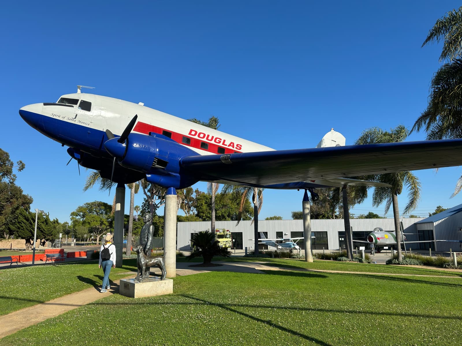
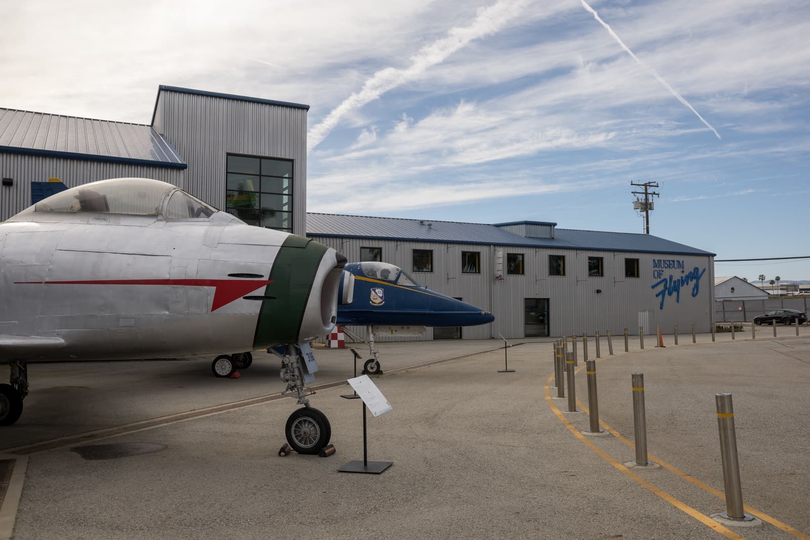
An aviation museum at 3100 Airport Avenue, on the field where Douglas Aircraft flew its first airliners.
Park25 min walk
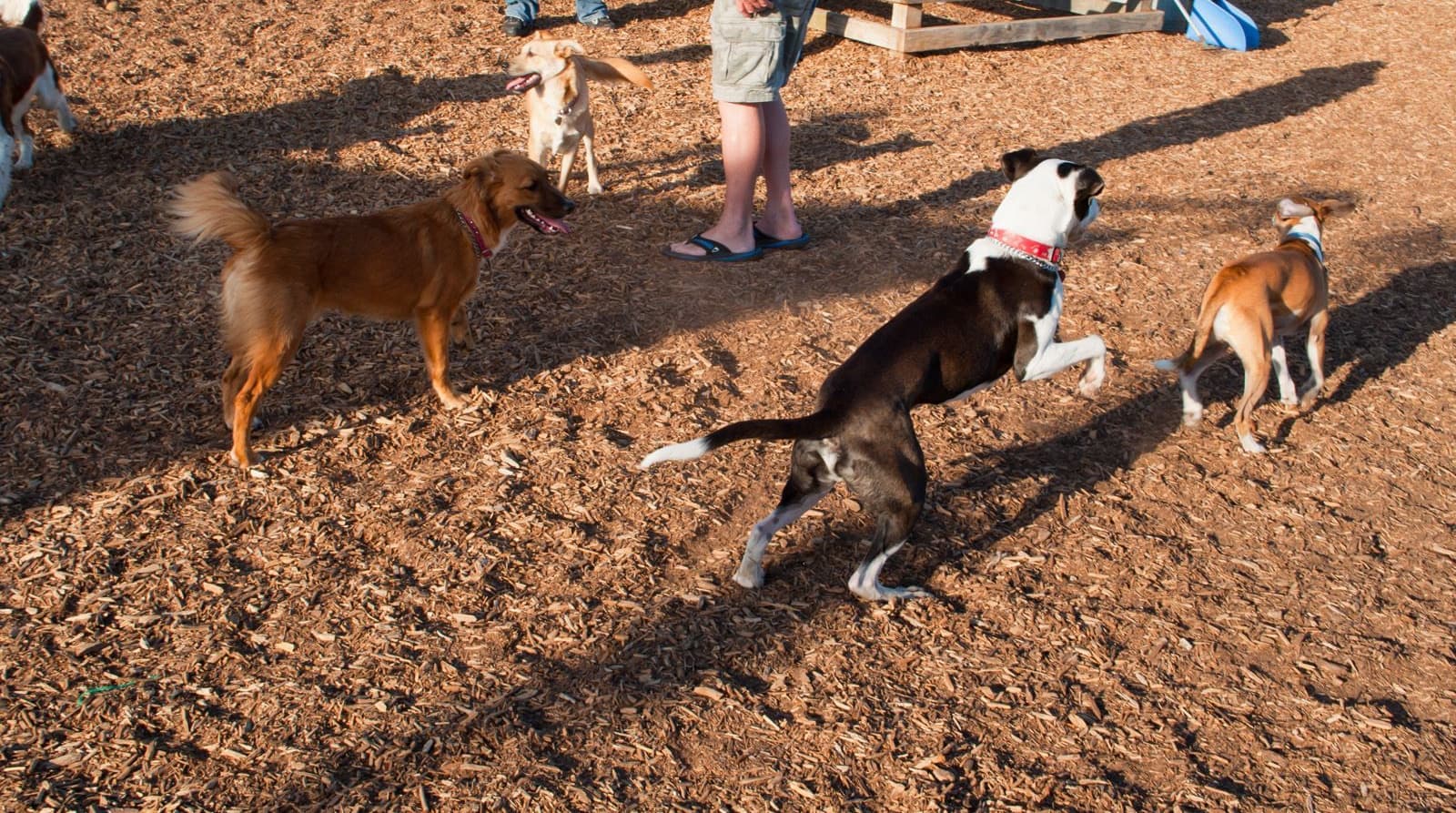
A park on airport land at 3201 Airport Avenue with a turf field, a playground and an off-leash dog park.
Park15 min walk
The neighborhood park at 1406 Marine Street, with ball fields, tennis and basketball courts, a playground and a community garden.
Landmark5 min walk
The Santa Monica Public Library branch at 2101 Ocean Park Boulevard.
Coffee5 min walk
A neighborhood cafe at 1741 Ocean Park Boulevard.
Restaurant5 min walk
A bakery at 1620 Ocean Park Boulevard, in the small strip of shops around 17th Street.
Restaurant15 min walk
A Mexican restaurant at 2526 Pico Boulevard, on the neighborhood's north edge.
Landmark10 min walk
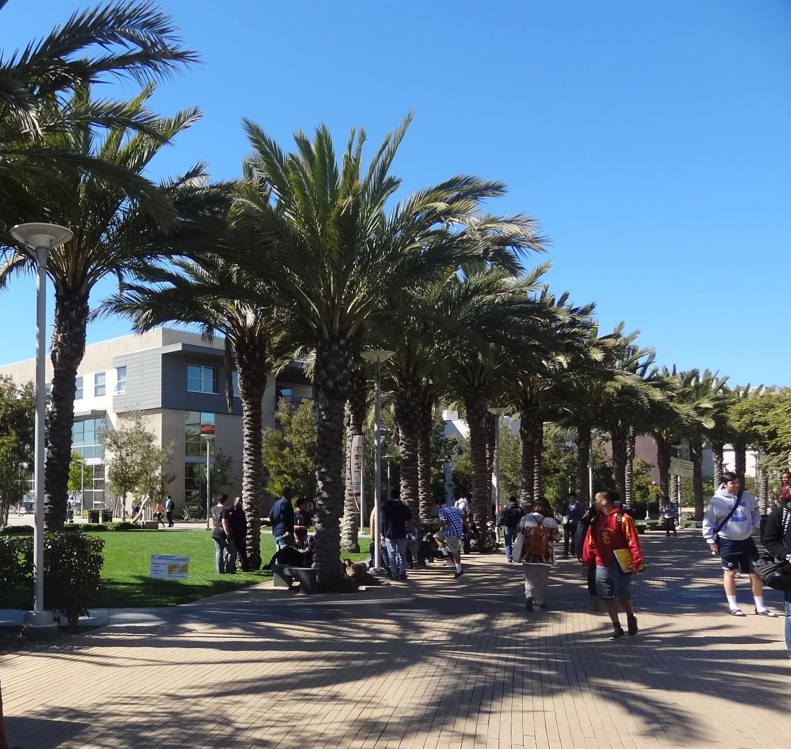
The college's main campus at 1900 Pico Boulevard, about 40 acres at the northwest corner of Sunset Park.
Recreation25 min walk
The city-owned airport on 192 acres, which the city plans to close at midnight on December 31, 2028 and turn into a park.
Shopping · Nearby10 min walk
The city's Saturday market at Virginia Avenue Park, 2233 Pico Boulevard, just across Pico on the north side.
Saturdays 8 a.m. to 1 p.m., year-round.
Houses from the 1930s and 40s on regular lots
What's on the streets, and what gets rebuilt.
The county's records put about 88% of Sunset Park's houses between the 1920s and the 1950s, and the 1940s are the biggest decade by far, at about 39%. Local histories tie many of these houses to Douglas Aircraft, which flew its first airliners from the airport, and the dates fit that story. The median house on the county roll is about 1,650 square feet with three bedrooms.
The lots are regular. About 79% of house lots are between 5,000 and 7,500 square feet, the median is about 6,750, and in the blocks I sampled most were 40 to 50 feet wide. Pearl Street, Hill Street and Ashland Avenue have the most houses. Some owners add a second story or an ADU, and some lots have been rebuilt from scratch; about 6% of recorded build years are 2000 or later.
Because most of the houses are R1, the same city rules as North of Montana apply: two stories, 28 feet, and a floor-area cap of 0.45 of the lot for a new two-story house, or 0.55 if you add on instead of demolishing. On a 6,750-square-foot lot that's about 3,040 square feet new, or about 3,710 if you keep and expand. ADUs, junior ADUs and the city's SB 9 duplex and lot-split rules apply here too.
The city's landmark list has seven entries inside our map, including the airport's 1928 rotating beacon tower, the Compass Rose at the airport, and the 1981 Sun Tech Townhomes on 28th Street.

- About 88% of houses were built between the 1920s and the 1950s
- Most lots are 5,000 to 7,500 square feet
- R1 rules cap a new two-story house at 0.45 of the lot
Living next to Santa Monica Airport
Who flies there now, and the noise rules the city enforces.
Pilots were landing on this mesa by 1917. The Army named it Clover Field in 1922 after Greayer Clover, a local pilot killed in the First World War, and the city bought the land in 1926 with a parks bond. In 1924 four Douglas World Cruisers took off from Clover Field on the first flight around the world, and Douglas flew its DC-1 prototype here in 1933. Today the airport covers 192 acres, about 3.5% of the city's land.
In December 2017 the city shortened the runway to 3,500 feet, and jet traffic fell hard: the city counted 2,973 jet operations in 2025, against 17,338 in 2016. Propeller traffic went the other way. Total takeoffs and landings reached 78,693 in 2025, up 39% from 2024, after a new flight school opened in April 2025. Since December 2025, JSX has flown scheduled service to Las Vegas on 30-seat turboprops under a lease that ends in November 2028.
The city's rules ban takeoffs from 11 p.m. to 7 a.m. on weekdays and until 8 a.m. on weekends, ban touch-and-go training on weekends, holidays and weekday nights, and fine aircraft that go over 95 decibels at the runway-end monitors. Planes take off toward the west about 95% of the time and are asked to turn north at the shoreline or south at Lincoln. One of the city's noise monitors sits on 18th Street between Dewey and Navy.
Air-quality studies from 2009 and 2010 found higher ultrafine-particle levels downwind of the runway, to the east in Los Angeles, and elevated lead near the tarmac. Both predate the runway cut. In 2022 the city switched its self-serve pump to unleaded fuel, though leaded avgas is still sold at the field.

- Jets fell from 17,338 operations in 2016 to 2,973 in 2025 after the runway was shortened
- Propeller traffic rose in 2025, with a new flight school
- No takeoffs 11 p.m. to 7 a.m. on weekdays, 8 a.m. on weekends
What the closure means if you buy now
The city's closure plan, and the fights that aren't over yet.
In January 2017 the city and the FAA settled their long fight over the airport. A federal court entered the consent decree on February 1, 2017. It requires the city to run the airport through December 31, 2028 and lets it close the airport after that, and the city council adopted a resolution the same month directing closure at midnight on December 31, 2028. The city restated that date in September 2025.
Before it can close, the council still has to certify an environmental review and take a final vote, which city staff expected by June 2028. Measure LC, which voters passed in 2014, limits the land to parks, open space and recreation, plus existing arts, culture and education uses, unless voters approve something else. In July 2025 the council chose a park plan that stays inside those limits and doesn't study housing. In March 2026 the city released a draft layout for the park, and in June 2026 it won $10 million in state funding for the project.
Not everyone agrees. A proposed ballot measure would put 3,000 affordable homes on a quarter of the land; it missed the November 2026 ballot, and its backers are now aiming for 2028. A pro-airport group has its own polling that says most residents want to keep it open in some form. My read is that closure is city policy with a federal consent decree behind it, but the details of what gets built, and when, are still being decided.
Today the airport is part of the price of living here, and the neighborhood's biggest change in decades is on the calendar. If you're looking at a house near the runway, weigh both halves: less noise and a large new park after 2028, and a construction period and possible ballot fights before then.
- The 2017 consent decree lets the city close the airport after December 31, 2028
- Measure LC limits the land to parks and open space unless voters decide otherwise
- A housing ballot measure is aiming for 2028; the council's plan is a park
Disclosures and rent control
The paperwork that's different in Sunset Park.
LA County's airport land use map for Santa Monica Airport, dated 2003, covers the airport and the runway protection zones off each end, and the western zone reaches over Sunset Park blocks roughly between 18th and 23rd streets near Dewey Street. The map predates the 2017 runway cut. If a house is inside that airport influence area, state law puts an airport-in-vicinity notice in the Natural Hazard Disclosure. Most of Sunset Park is outside it, and the address decides.
Rent control works the same as elsewhere in Santa Monica. About 90% of the neighborhood's apartment units are in buildings from before 1979, so most are controlled, and the September 2026 increase is 2.6%. Most houses and separately sold condos can be rented at market rates under the state's Costa-Hawkins Act, but the city's just-cause eviction rules still apply.
The city's liquefaction map touches a few blocks at the far east end, mainly along 34th Street and Centinela Avenue. There's no state earthquake fault zone and no FEMA special flood hazard area in the neighborhood.
- Houses near the west end of the runway may carry an airport-in-vicinity notice
- Most apartments are rent-controlled; the September 2026 increase is 2.6%
- A small liquefaction area at the far east end, around 34th Street
Daily life around Clover Park
The cafes on Ocean Park Boulevard are a walk away, and your elementary school depends on the block.
Clover Park at 2600 Ocean Park Boulevard is the big park, over 17 acres of fields, tennis courts and picnic areas right next to the airport. Airport Park on Airport Avenue has a turf field and an off-leash dog park, and Marine Park at 1406 Marine Street covers the southwest side. The Fairview Branch Library is at 2101 Ocean Park Boulevard.
For coffee and bread, the strip of Ocean Park Boulevard around 17th Street has Cafe Bolivar and Jyan Isaac Bread, and there's a shopping center with restaurants near 29th. Pico Boulevard has more restaurants, including Gilbert's El Indio, and on Saturdays the city's Pico Farmers Market runs at Virginia Avenue Park, just across Pico. The beach is one to two miles west, depending on the block.
Sunset Park is in the Santa Monica-Malibu Unified School District. When I ran Sunset Park addresses through the district's school locator in September 2026, the ones I checked west of about 21st Street came back Will Rogers Learning Community at 2401 14th Street, and the ones around 23rd and 25th came back Grant Elementary at 2368 Pearl Street. All went to John Adams Middle School and Santa Monica High. I'd check the exact house with the district before you plan around either one.

- Clover Park, Airport Park and Marine Park
- Cafes on Ocean Park Boulevard and the Saturday Pico market
- Will Rogers or Grant depending on the block, then John Adams Middle and Samohi
What's for sale and what I check on a house
The median house listed in September 2026 was asking around $2.8 million.
Our Sunset Park map had 9 houses for sale on September 25, 2026, asking about $2.0 million to $4.0 million, with a median around $2.8 million. There were also 6 condos from about $715,000 to $1.5 million, 2 townhouses, and 8 small income properties from about $1.56 million to $3.95 million.
On a Sunset Park house I spend time on the street at different hours, because the airport, the college and Pico traffic all show up at different times. Then the permits on any additions, since a lot of these houses have grown over the years, a sewer line and foundation inspection on the older ones, and the Natural Hazard Disclosure for the airport notice. If you're buying with a rebuild in mind, have an architect run the R1 numbers first.
- 9 houses listed on September 25, 2026, asking about $2.0M to $4.0M
- Visit at different hours to hear the airport and the traffic
- Permits on additions and the airport notice on the disclosures
More Sunset Park facts
- ~2,600HousesSingle-family parcels on the county map
- ~88%Built 1920s to 1950sThe 1940s alone account for about 39%
- 5,000 to 7,500 sq ftTypical lotAbout 79% of house lots; median about 6,750
- 192 acresAirport landAbout 3.5% of the city, set to become a park
- After Dec 31, 2028Airport closureAllowed by the 2017 consent decree with the FAA
- 78,693Flights in 2025Takeoffs and landings, up 39% from 2024





Rentals in Sunset Park
21 active rentals in the mapped area
$18,500/mo
Single-Family5 bd5 ba3,145 sqft
1733 Robson Avenue
$3,095/mo
Condo1 bd1 ba500 sqft
1405 OCEAN PARK Boulevard D
$14,000/mo
Single-Family4 bd5 ba3,000 sqft
1420 ASHLAND Avenue
$3,200/mo
Apartment1 bd1 ba530 sqft
1033 Grant Street
$8,500/mo
Single-Family3 bd2 ba1,527 sqft
2449 23rd Street
$14,500/mo
Single-Family6 bd6 ba3,997 sqft
2445 22nd Street
$2,600/mo
Condo1 bd1 ba725 sqft
1412 Pearl Street 5
$11,575/mo
Single-Family4 bd3 ba1,690 sqft
1701 Pier Avenue
$2,900/mo
Condo1 bd1 ba725 sqft
1112 Ocean Park Boulevard F
$2,795/mo
Apartment1 bd1 ba800 sqft
1128 Ocean Park Boulevard 101
$3,800/mo
Condo2 bd1 ba920 sqft
1112 Ocean Park Boulevard D
$5,750/mo
Condo3 bd3 ba1,950 sqft
820 Pier Avenue 1
$1,975/mo
Condo1 bd1 ba19,021 sqft
2637 Centinela Avenue 9
$10,995/mo
Single-Family3 bd2 ba
1808 Navy Street
$6,200/mo
Townhouse3 bd3 ba1,335 sqft
2337 Oak Street 2
$2,750/mo
Residential2 bd2 ba700 sqft
2437 Centinela Avenue apt 10
Questions & answers
Sunset Park is the southeastern part of Santa Monica, south of Pico Boulevard and east of Lincoln Boulevard, running to the Los Angeles city line on the south and east. Santa Monica Airport is along its southern edge, Santa Monica College's main campus is at its northwest corner, and Clover Park is in the middle. The Friends of Sunset Park is the neighborhood group the city lists for the area.
Explore near Sunset Park
1.3 mi awayOcean ParkSanta Monica's beach corner south of Pico Boulevard, with Main Street running through itRead the guide ›2.0 mi away · Los AngelesVeniceSmall beach lots on canals and walk streets, inside the City of Los AngelesRead the guide ›2.6 mi awayNorth of MontanaSanta Monica's single-family streets between Montana Avenue and the canyon rim, from Ocean Avenue to 26th StreetRead the guide ›5.2 mi away · Los AngelesBrentwoodCanyon houses above Sunset and big-lot streets below it, on the west side of the 405Read the guide ›5.4 mi away · Beverly HillsThe Beverly Hills FlatsCurving 1906 streets between Santa Monica Boulevard and Sunset, each planted with its own kind of treeRead the guide ›6.4 mi away · Los AngelesBeverly GroveThe flat Los Angeles blocks between the Beverly Hills line and Fairfax Avenue, where most of what sells is a boulevard condo or a 1920s duplexRead the guide ›
Where we check the facts
The facts in this guide (districts, zones, rules) come from the official records below. We re-check them before property tours.
- City of Santa Monica: neighborhood organization boundariesgisdata.santamonica.govwhere Sunset Park starts and stops
- City of Santa Monica: the future of the Santa Monica Airportsantamonica.gov192 acres, 1926 purchase, planning process
- City of Santa Monica: airport closure at the end of 2028santamonica.govconsent decree and closure date
- City of Santa Monica: council direction on the airport parksantamonica.govJuly 2025 park plan and Measure LC
- City of Santa Monica: airport closure update (2024)santamonica.govconsent decree terms, runway, remaining steps
- City of Santa Monica: airport operations and noise reportssantamonica.gov2025 traffic, curfew, flight paths, noise monitors
Show all 19 sourcesShow fewer
- PBS SoCal Lost LA: before Santa Monica Airport there was Clover Fieldpbssocal.orgClover Field, World Cruisers, DC-1
- LAist: airport housing ballot measure delayedlaist.com3,000-home proposal aiming for 2028
- Santa Monica Daily Press: JSX begins flightssmdp.comscheduled service and lease term
- LA County Airport Land Use Commission: Santa Monica Airport mapcase.planning.lacounty.govairport influence area
- Santa Monica Rent Control Board: 2025 annual reportsmgov.netcontrolled units and Costa-Hawkins
- Santa Monica Rent Control: maximum lawful rentsantamonica.govSeptember 2026 general adjustment
- Santa Monica Municipal Code, Chapter 9.07 (R1 district)ecode360.comheight and floor area
- City of Santa Monica: Clover Parksantamonica.govpark size and amenities
- SMMUSD school locatorlocator.pea.powerschool.comschool assignment by address
- City of Santa Monica GIS datagisdata.santamonica.govzoning, landmarks, liquefaction areas
- Los Angeles County Assessorportal.assessor.lacounty.govlot sizes, house counts, recorded build years
- U.S. Census Bureau: American Community Surveydata.census.govrenter and owner shares
- CRMLSgo.crmls.orgactive listings
Photo credits (8)
- The 1942 Douglas DC-3 on display outside the Museum of Flying at Santa Monica AirportSteve Shelokhonov (Commons: Steveshelokhonov), CC BY-SA 4.0
- Santa Monica Airport in 2005, looking east across the ramp toward Century CityDaniel Baker, Public domain (PD-author)
- The ball field lawn at Marine Park, on the south side of Sunset ParkClyde Charles Brown, CC BY-SA 4.0
- Evening sun on a railed walkway above the ramp at Santa Monica AirportJulien Barrier, CC BY-SA 2.0
- Late sun at the dog run in Airport Park, a park already built on airport landScarlet Sappho (Flickr: InSapphoWeTrust), CC BY-SA 2.0, cropped
- Palms shade the main walk at Santa Monica College, at the neighborhood's northwest cornerMrgates, CC BY-SA 3.0, cropped
- Midday sun on the lawn and pines at Clover ParkIlya Haykinson, CC BY-SA 2.0, cropped
- Vintage jets parked outside the Museum of Flying on Airport AvenueClyde Charles Brown, CC BY-SA 4.0